
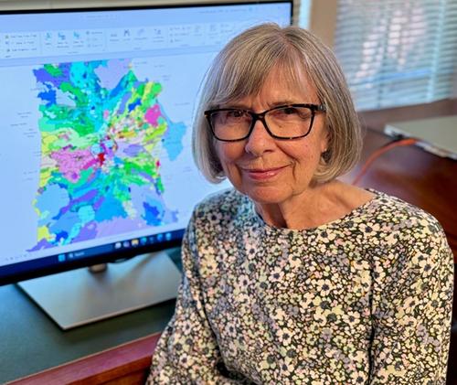
Julie Donnelly-Nolan
US Geological Survey
In this article
2026 GSA Florence Bascom Geologic Mapping Award
Presented to Julie Donnelly-Nolan
Citation by Thomas W. Sisson
Julie Donnelly-Nolan has devoted her career to revealing and understanding the styles, causes, and hazards of Quaternary volcanism investigated through detailed geologic mapping and related studies. She has mapped thousands of square kilometers of sinuous thin lava flows, lava domes, obsidian flows, ignimbrites, and faults of some of the largest active volcanic fields of the westernmost conterminous United States. Julie initiated and accomplished these tremendous mapping efforts employing all the supporting tools available—petrography, geochemistry, paleomagnetism, geochronology, lidar, and even drill cores, but her principal tool and key to success were her insightful field observations applied persistently. Julie established the evolution in space and time of the Clear Lake Volcanic Field, California, by K-Ar dating more than 60 units for her Ph.D. thesis at Berkeley. Clear Lake is a site of slab window magmatism behind the northward migrating plate triple junction now at Cape Mendocino and it hosts the United States’ most productive geothermal power source, the 1.6 GW Geysers geothermal area. Her eruptive history is foundational for understanding that critical resource.
Julie then undertook the massively ambitious task of mapping the enormous Medicine Lake Volcano (~2000 km2), northern California. Medicine Lake is one of three expansive and voluminous Quaternary volcanic centers that grew 35–50 kilometers behind (east of) the arc-front stratovolcanoes of the Cascades convergent margin, the others being Newberry Volcano, Oregon, and the now inactive Simcoe Mountains Volcanic Field, Washington. Among other findings, Julie discovered that many of Medicine Lake’s basaltic and andesitic lava flows are compositionally zoned, and she, with long-time collaborator Tim Grove and his students, used this zoning to develop insights into processes that created the compositional diversity and how eruptions then tapped this progressively. She also discovered through examining geothermal exploration drill cores that the now mainly mafic-to-intermediate volcano erupted large volumes of felsic lava. Julie capped her Medicine Lake work by converting her findings on eruption history and style into a quantitative assessment of volcanic hazards.
Julie followed Medicine Lake by mapping the geology and establishing the eruptive history of the even larger Newberry Volcano (~3100 km2) centered about 35 kilometers south of the growing city of Bend, Oregon. Like Medicine Lake, Newberry is surfaced dominantly by basaltic through andesitic lava flows that have subdued volcanic landforms and similar overall appearances, with the further complication that Newberry is widely blanketed by Mazama tephra, reducing continuous exposures. Important findings relevant to Bend and vicinity include that Newberry erupted multiple compositionally zoned ignimbrites from its caldera and also that Newberry’s rift-zone eruptions can effuse diverse magmas from widely separated vents near-contemporaneously. She recognized evidence that Newberry had been glaciated, unexpected owing to its moderate elevation and position in the Cascade rain shadow. A critical discovery made in collaboration with Bob Jensen is that Newberry lava flows reached the Deschutes River certainly twice and probably more often. About 65,000 years ago a Newberry lava flow dammed the Deschutes River and formed a large lake. When the dam failed, a massive outburst flood swept down the Deschutes through the present area of Bend, transporting and depositing the multi-meter-sized lava boulders that are scattered along the river channel. A future such event could be catastrophic, but thanks to Julie’s leadership, the hazard is firmly established and understood, so evacuations could be undertaken if lava again reaches the river. Julie is presently drafting a comprehensive assessment of Newberry’s volcanic hazards based on her geologic mapping and insights on eruptive history and behavior, and this report will help to prioritize resources and mitigate the effects of future unrest.
Julie, like Florence Bascom, is an exemplary field geologist, but she further mirrors Florence Bascom as a mentor and facilitator. Julie has organized and led scores of geologic field trips to Clear Lake, Lava Beds National Monument, Medicine Lake, and Newberry Volcanoes, introducing graduate students and early-career scientists to promising field sites and issues, and then advising on their research studies. She recognized that techniques and understanding in geochronology, geophysics, and physical volcanology have advanced greatly since her pioneering work so as to merit reinvestigating the Clear Lake Volcanic Field. Thanks to her vision and advocacy, a new era of scientific research and discovery is taking place at Clear Lake, the active volcanic field only 150 kilometers north of San Francisco and a major source of geothermal power. Julie’s dedication to exacting field geologic studies for the public good sets the standard for that new era to emulate. Thank you, Julie, for your career-long dedication to field geology that enabled your many, lasting, and inspirational accomplishments, and congratulations on receiving the Geological Society of America’s 2026 Florence Bascom Geologic Mapping Award.
Response by Julie Donnelly-Nolan
I am very grateful to receive the Florence Bascom Award for Geologic Mapping. More importantly, I appreciate the attention that GSA has brought to the value of geologic mapping. My goal at each of the three volcanic centers where I've worked (Clear Lake, Medicine Lake, Newberry) was to understand the evolution of each system in space, time, and composition. This requires recognizing and mapping out the lava flows and their stratigraphic relationships, finding their vents, and creating a picture of the volcano’s history and its potential hazards.
At the Clear Lake volcanic field in northern California where I did my PhD thesis, I was lucky to meet Carter Hearn who had just begun a USGS geothermal project on the Geysers-Clear Lake area. He hired me to help with the mapping and do the argon dating in Berkeley's K-Ar lab. I had done a few months of afternoons mapping in the Berkeley Hills with all the new Berkeley grad students, but the Clear Lake work was my first real experience doing geologic mapping. I didn't do summer field camp because my undergraduate degree is in political science. In the argon lab I produced nearly 70 K-Ar ages that enabled me to understand the evolution of the volcanic field in time and space.
My first USGS project was to map Medicine Lake volcano, a large volcano in northern California that was considered a potential geothermal energy target. I was lucky again because as I began the work, I met Tim Grove (a new professor at MIT) who was just beginning his petrologic study of the volcano. I shared my mapping of compositionally zoned lava flows and suites of magmatic inclusions found in the young obsidian flows with him and his students and we collaborated on numerous studies. During this time, both of my children were born, Matthew in fall 1984, and Katherine in winter 1987, and luck was with me again when the owners of the little motel where I stayed in Tulelake CA offered to do childcare while I worked. My husband Mike, a USGS hydrologist, had fieldwork elsewhere.
The geologic map of Medicine Lake volcano was published in 2010, but by then I had moved north to map the even larger, hotter, and more explosive Newberry Volcano in central Oregon. Here local support was important in getting access to some private property. Deschutes National Forest geologists Larry Chitwood and Bob Jensen provided help and enthusiasm for the project, but Larry died soon after his retirement. Bob decided to retire early and lucky for me, became an official USGS volunteer. He assisted with much of the fieldwork, did some independent mapping, and is a coauthor on the map. When Bob was mapping along the Deschutes River through Bend, he found hundreds of multi-meter-size boulders along the channel. We realized that a Newberry lava flow had dammed the river providing the water source for the Bend outburst flood that Mike Nolan and Jim O'Connor have modeled.
Other local support included Daniele Mckay, a U of Oregon PhD student who collaborated on the compositionally zoned and extensive post-Mazama northwest rift zone eruption and later founded the Central Oregon Geoscience Society and is now a U of O faculty member. Meanwhile Tim Grove and collaborators focused on the petrology, and my USGS colleague Duane Champion began an extensive paleomagnetic study. We had worked together on the young lavas at Medicine Lake volcano, but the Newberry work involved more than 400 sites in about 135 units. Among these, excursional sites were identified. These were then targets for argon 40/39 dating by my USGS colleagues Andy Calvert and Mark Stelten. Duane died as the map was being assembled, so he never got to see the final product of his efforts. Much of the assembly (writing about 300-unit descriptions, constructing the correlation of map units, writing the map text) was done at home during the pandemic. Our USGS GIS expert Joel Robinson sent me instructions and did all the final assembly in ArcMap. As I write this in September 2026, Joel has done the final geodatabase work and the map is on the verge of being published, first digitally, and then in print.
I need to thank my family and my USGS family. I have been fortunate to work for the USGS Volcano Science Center currently led by Jake Lowenstern, with its several observatories (AVO, HVO, CVO, CalVO) and its international response team. Volcano hazards funding has supported long-term volcano studies like the Medicine Lake and Newberry work in the knowledge that such studies provide a foundation for understanding volcanic systems. My colleagues at CalVO, formerly in Menlo Park, now at Moffett Field, have been a major source of support. Phil Dawson leads our diverse group of geologists, geophysicists, geochemists, post-docs, and emeriti. Several Newberry-related projects are ongoing, including a new look at the paleomagnetic data by Tony Pivarunas, petrology of the northwest rift zone by Dawn Ruth, and a detailed tephra study by Judy Fierstein. I'm pleased to see the progress made by the new Clear Lake team (Seth Burgess, Dawnika Blatter, Jessica Ball, plus Tony Pivarunas and Andy Calvert) at understanding this transform-fault-related volcanic field. Gas geochemists Jen Lewicki and Sara Peek work at both Newberry and Clear Lake. Colleagues Mike Clynne and Charlie Bacon provide their knowledge of southern Cascade volcanoes Lassen and Crater Lake, and Tom Sisson shares his petrologic perspectives on arc volcanic processes. I'm grateful to Tom for nominating me for this award and for writing his citation. I'm also grateful to those who wrote letters in support of my nomination. I owe special thanks to long-time friend and fellow geologic mapper Anita Grunder who presented my response at the GSA awards ceremony when I was unable to attend.