
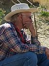
Mervin J. Bartholomew
University of Memphis
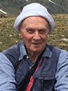
Giorgio V. Dal Piaz
University of Padova, Italy
2023 GSA Florence Bascom Geologic Mapping Award
Presented to Mervin J. Bartholomew and Giorgio V. Dal Piaz
Citation by Will Jackson
With the 2023 Florence Bascom Geologic Mapping Award we celebrate Professor Mervin Jerry Bartholomew’s passion for mapping, for field work, and his contributions to the earth science community. Jerry Bartholomew has conducted seminal, field-based research in both state survey and academic settings over the last 50-plus years. Jerry’s mapping, the process and the products, have advanced our understanding of the Grenville orogeny, mechanical rock behavior during thrusting, the spatial-temporal interaction of Laramide and Seiver style deformation, as well as seismic hazard assessments in tectonically active regions such as Charleston, South Carolina, the Imperial Valley, California, Centennial Valley, Montana, and the eastern Tibetan Plateau. His work has produced 34 (and counting) geologic maps and technical reports through the Montana, North Carolina, and Virginia state surveys, 20 professional and society field trip guidebook contributions, and 94 peer-reviewed publications (with more under review and under construction).
Jerry’s ability to read the landscape and to recognize how it formed is exemplary, and he has used that skill to make geology accessible to others. His focus on using field science as a means for empowering students; for supporting their curiosities; and for building multidisciplinary collaborations is evident in each of his maps. He has trained countless field scientists through teaching summer field camps, during focused field research campaigns, and on topically focused field trips. Jerry continues to work with colleagues and students, in the field, mapping, and reading the landscape to reveal the sequence of geologic events and the processes of those events. His colleagues and students are forever grateful for his science, mentoring, and friendship.
Response by Mervin J. Bartholomew
I grew up along the West Branch of the Susquehanna River (PA) where it flows along the Alleghany Front. To the north are flat-lying Devonian-Mississippian coal-bearing rocks of the Alleghany Plateau. To the south, steeply dipping Silurian sandstones form the flank of the Nittany anticline. Back then, no one used maps, but we looked at the terrain - both ahead and behind – to recognize landmarks. My main undergraduate mentors at Penn State were Robert Scholten (6-weeks of living intents and mapping on airphotos in the Tendoy Range, near Lima, MT), Richard Jahns (Oak Hall quarry) and William Sanders (excavating archaeological sites, valley of Teotihuacan, Mexico).
In the mid-sixties, I worked for Chevron along the Inglewood-Newport fault (in the Baldwin Hills, CA). I contoured both fault surfaces and stratigraphic horizons which led to significantly better prediction for directionally drilled bottom-hole locations within fault blocks. The first wells at Chevron’s historic West Pico drill site were completed several miles away under Beverly Hills. Richard Merriam and Gregory Davis, my mentors, at the Southern Cal encouraged me to publish my first paper in1970 on the active San Jacinto fault - just west of the Salton Sea (CA).
I completed my PhD at Virginia Tech with Byron Cooper, Charles Gilbert, and Wally Lowry as principal mentors. At NCSU, I taught field camps in the White and InyoRange (CA) and at Saltville (VA), then returned to geologic mapping for the North Carolina and Virginia geological surveys. I concentrated on parts the New River region from the Blue Ridge across the fold and thrust belt to the frontal fold that marks the edge of the Cumberland Plateau at the NE end of the Southern Appalachians.
I headed west again, and the MBMG gave me an opportunity to make maps with colleagues across Montana at various scales for nearly a decade! Then a decade at the University of South Carolina analyzing relative ages of Mesozoic to Holocene joints and faults in quarries, clay pits, and outcrops including muti-year studies around the Savannah River Site (SC and GA) and the potential low-level radioactive waste site (Raleigh, NC).
Since joining the Earth Sciences faculty (University of Memphis) 20 years ago, I have worked on Appalachian geology, on aspects of Laramide and Sevierdeformation, and on Quaternary deformation. I spent a decade teaching the YBRA field camp near Red Lodge (MT) and then I returned to Montana to map and trench active faults in the Centennial Valley and analyze LPS in the Tendoy Range. The last decade was mapping and trenching active faults related surface ruptures associated with the 2010 Yushu and 1955 Zheduotang earthquakes in the Tibetan foothills of China with faculty from the China University of Geosciences, Wuhan. I’ve learned a lot over these 50 years!
Citation by Carlo Doglioni
Since the early stages of his career as a geologist, moving from the Institute of Geology of Padua to the one in Turin (northern Italy), Giorgio Vittorio Dal Piaz was devoted to mapping and unravelling the most hidden secrets of the Alps, improving the long tradition of Swiss geologists such as Emile Argand and many others. His tireless work over more than 60 years has provided fantastic improvements in the understanding of one of the most studied and complicated orogens in the world: he mapped several areas in the core of the western Alps, deciphering the fundamental processes governing the subduction of the oceanic Tethyan basin and the related Mesozoic passive continental margins and the variscan basement, until the collision between the Adriatic and the European plates. Giorgio Vittorio has also been the soul of the “Structural Model of Italy”, an extraordinary mapping effort supported by a long list of Italian authors who were galvanized by his energy and enthusiasm. This incredibly useful and updated geological map covering the Alps, the Apennines, the external Dinarides, and the central Mediterranean seas, is a fundamental basis for any student and professional scientists working in this tectonically puzzling part of the world. In a world where fewer geologists aim to work in the field, preferring numerical modelling or writing papers without adequate direct knowledge of the area, Giorgio Vittorio remains rooted in geology entirely relying on observational data from the ground, collecting samples in the backpack, doing thin sections in the lab, to be later carefully scrutinized at the microscope, and then finalizing the geological map. Having this attitude, Giorgio Vittorio fundamental contribution spans from the discovery of continental lithosphere subduction and the related high-pressure-low-temperature metamorphism of slab exhumation slices through detailed mapping, to the description of innovative cross-sections across the Alps. Giorgio Vittorio Dal Piaz is part of a family tradition of outstanding geologists, from its grandfather Giorgio, and his father Giambattista, to his son Giovanni. His scientific work shed fresh new light on the structure of the alpine orogen and the geodynamic evolution of the Mediterranean area: the Florence Bascom Award couldn’t be more deserved.
Response by Giorgio V. Dal Piaz
I am very honored and grateful to GSA for the Florence Bascom Geologic Mapping Award. I started approaching and learning geologic mapping in 1957-58, during my undergraduate course in Geological Sciences at the University of Padua (Italy), with exercises on volcano-sedimentary successions of the Venetian Alps and the final evaluation of a personal map. I was also fortunate to learn modern petrography and light microscope recognition of minerals and fabrics of igneous and metamorphic rocks by Prof. Bianchi and his assistants. I applied these field and laboratory techniques during my dissertation on metamorphic units of the Monte Rosa massif, inspired by the Swiss maps and notes of Peter Bearth, a great alpine geologist and lone climber. I systematically practised this powerful analytical tool in the next sixty years of research and mapping in the Alps, from October 1960 in the early stages of my academic career at the Institute of Geology in Turin. Since 1974, when I moved back as professor at the University of Padua, I focused on the structure of the Alpine collisional nappes derived from the African-Adriatic plate (Matterhorn, Sesia-Lanzo) and European (Monte Rosa, Monte Bianco) continental margins and comprising the ophiolitic suture of the Mesozoic Tethys ocean. I was gladly the tutor of many students, always engaging them in fieldwork and geologic mapping, recognizing that it was a fundamental training tool for every young geologist.
Why geology? Someone might reasonably think that, as the son and grandson of two academic geologists, my destiny was inevitably written, but they did absolutely nothing to encourage me to follow their path: any attempt would have been counterproductive for a “contrarian” like I was at eighteen. An important role was played indirectly by my mother, who had climbed the Matterhorn before her marriage: she taught me to love the Alps and mountaineering, indirectly opening the road to geology for me. My family spent every summer in the Alps and while my father was busy mapping the Tauern window, my mother took my sister and me on long walks in the alpine wilderness. During high school, I attended the Alpine Club and its mountaineering training and did some climbing in the Alps, but my dream was the Himalayas, fueled by reading books and reports on Himalayan expeditions. The Annapurna was the first 8000 to be conquered (1950), the race for Everest was underway, and noting that some teams also included a scientist I realized that I too could go to the Himalayas as a geologist: this was the decisive argument for my geologic choice. As soon I graduated, in 1961 I participated as a young geologist in the expedition of the Alpine Club of Turin to the Cordillera Blanca (Peruvian Andes), and shortly afterwards I could have taken part in a mountaineering expedition in the Himalayas, but I gave up: I had found my Himalayas in the intriguing geology of the Alps!
The Western Alps are a small but significant segment of the Alpine-Himalayan collision system that offers an exceptional diversity of rocks, geologic phenomena and problems, along with two centuries of pioneering and modern research and mapping. Among my favorite topics I would mention the eclogitic metamorphism in the North-Western Alps, whose P-T gradient in the early 1970s had become the innovative proof of a subduction process of oceanic and continental units, then exhumed into the orogenic wedge: in particular, the eclogitic imprint of the Austroalpine Sesia-Lanzo nappe has demonstrated, against geophysical tenets at that time, that even a coherent fragment of light continental crust had been deeply subducted along with the oceanic lithosphere of the lower plate (Mem. Soc. Geol. It, 1972). From this research was born the three-year “ITALY-USA Cooperative Project (CNR-NSF) on HP-LT metamorphism in the Western Alps”, led by Bob Coleman and Gary Ernst for the American part and by me for the Italian one, grouping young geologists and petrologists of the Universities of Turin and Genoa and the collaboration of some Dutch, French and Swiss colleagues: it was an exciting adventure and our training benefited a lot. My research on the Alps continued to be based on fieldwork, unravelling the evolution history of the collision belt, making detailed maps and collaborating to the Structural Model and the new Geological Map of Italy at 1:50,000 scale.
With sincere humility, I can say that my work is in the groove of the Italian mapping tradition that had a brilliant beginning with the Italian Geological Service which, at the turn of the XIXth and XXth centuries and based on a detailed survey, drafted the Geological Map of the Western Alps at 1:400,000 scale (1908), a perennial monument of geologic mapping of mountain ranges and for its five authors-Franchi, Mattirolo, Novarese, Stella and Zaccagna. Detailed mapping for research and applications has to be a competence and habitual tool of modern geologists as well. It is therefore very important that GSA wanted to establish this specific award and it is very nice that it is devoted to Florence Bascom, a pioneer in field geology. She found three eminent colleagues in the Alps, the well-known Maria Matilda Ogilvie Gordon (1864-1939) and Marta Cornelius-Furlani (1886-1974), followed by Silvia Zenari (1895-1956), a graduate in Natural Sciences from Padua and the first and only Italian woman in the qualified male survey staff of the Geological Map of Three Venetias and Italy.
The gratitude I owe to my wife Adriana and my two sons is incalculable, and now that I’m retired, I am very nostalgic for my students and pupils, the field trips and research we did together.