
Maps
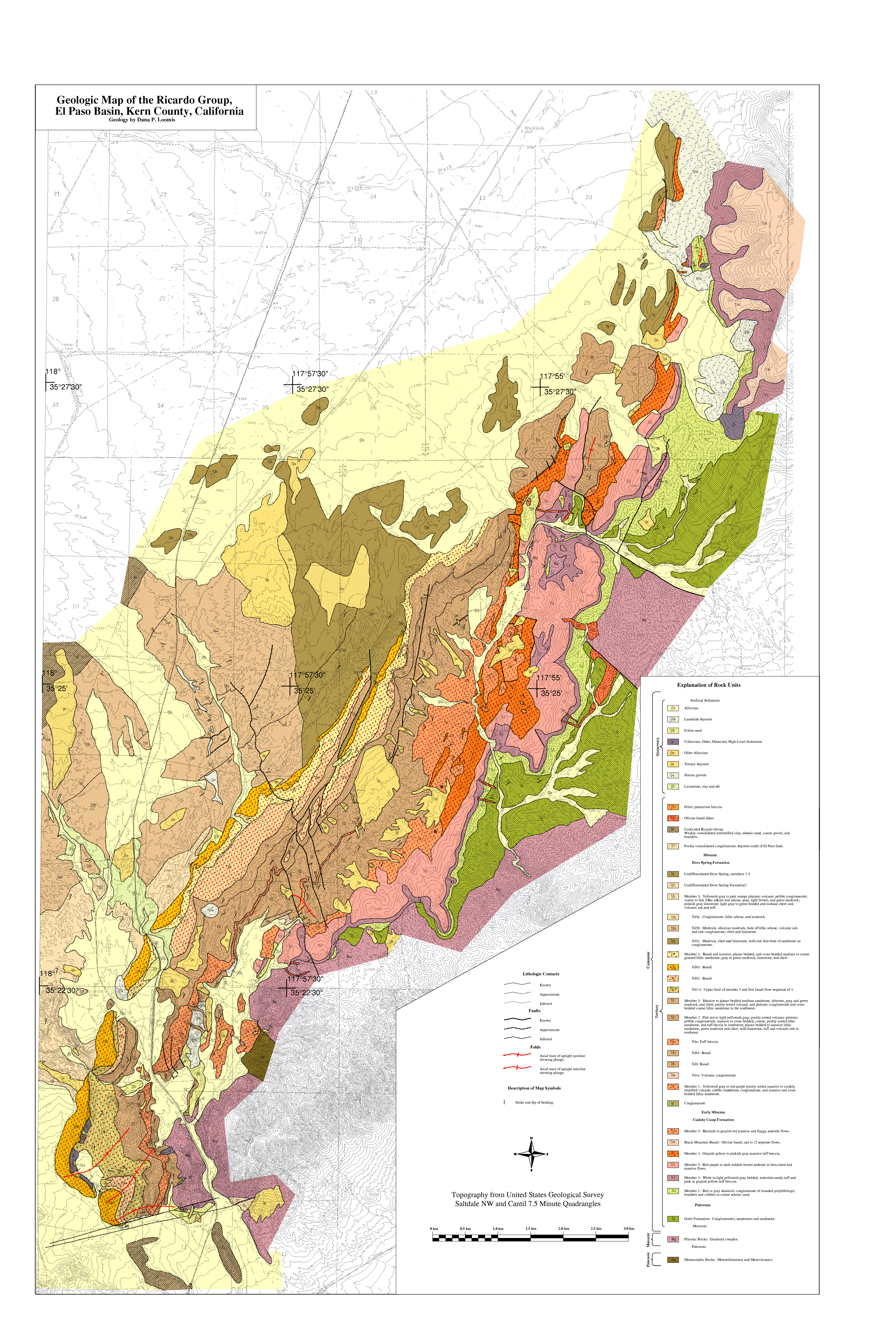
Geologic Map of the Ricardo Group
Dana P. Loomis
Data Originator:
Ross Black
Dept. of Geology, Univ. of Kansas
black@kuhub.cc.ukans.edu
doi: 10.1130/1984-loomis-ricardo
Year: 1984
Area: El Paso Basin, S. California
Scale: 1:24,000
Resolution: Variable
Projection
UTM
Parameters: Zone 11, Datum NAD83, Spheroid GRS1980
Units: Meters
Precision: Single
Description:
Keywords: Loomis, El Paso, Geologic Map, Map Images (PDF, PNG, PostScript)
Map image files:
Geograpic Information System (GIS) files:
What is GIS?