
Maps
Aeromagnetic Map of the Indian Wells Valley, East-Central California, and Surrounding Area
Allan M. Katzenstein1, Francis C. Monastero1, and Robert C. Jachens2
1Geothermal Program Office, Naval Air Weapons Station, China Lake, CA 93555
2U.S. Geological Survey, Menlo Park, CA 94025
Data Originator:
doi: 10.1130/9999-katzenstein-aeromagnetic
Year:
Area:
Scale:
Resolution: 300 dpi
Projection
Parameters:
Units:
Precision:
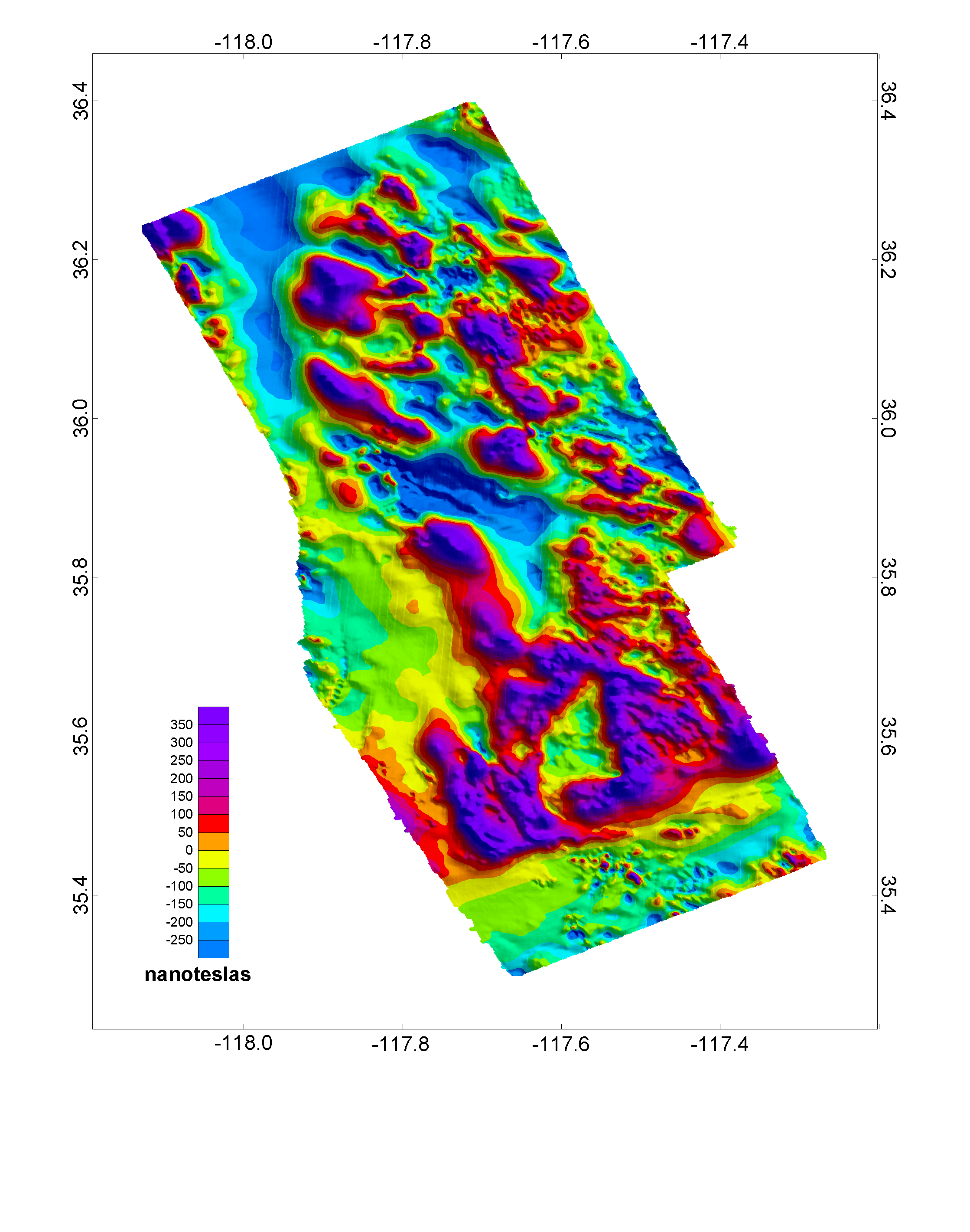
Description: In November 1994 an aeromagnetic survey was flown over the Indian Wells Valley and surrounding area in east-central California. The survey was a joint effort between the Geothermal Program Office, Naval Air Weapons Station, China Lake, CA, and the U.S. Geological Survey, Menlo Park, CA.
The survey consists of more than 9,033 line-kilometers, covering approximately 4,150 km2 in the northeastern Mojave Desert and the southwestern Basin and Range. It was flown at a 250 meter drape (height above average terrain) with a principal line spacing of 0.54 km and 10% cross-lines. The principal line orientation is N65(E. Data were acquired using a cesium vapor magnetometer, and were corrected for short-period diurnal and atmospheric effects. The data were further corrected by removing the International Geomagnetic Reference Field (IGRF), updated to the time of the flight resulting in a residual map with respect to the IGRF.
Figure 1 was constructed using Oasis Montaj software from Geosoft, Inc. of Toronto, Canada. We combined more than 480,000 corrected data observations to produce a gridded and contoured map. The product was then converted to the tagged image format (tiff) at a resolution of 300 dots per inch.
Keywords: Map Images (PNG)
Map image file (PNG):