
Maps
Geologic Map of the Ankara Mélange
A.M.C. Sengör
doi: 10.1130/2003-dilek-ankara
Year: 2003
Area: Ankara Mélange
Scale: 1:25,000
Resolution: Variable
Projection
UTM
Parameters: Zone 11, Datum NAD83, Spheroid GRS1980
Units: Meters
Precision: Single
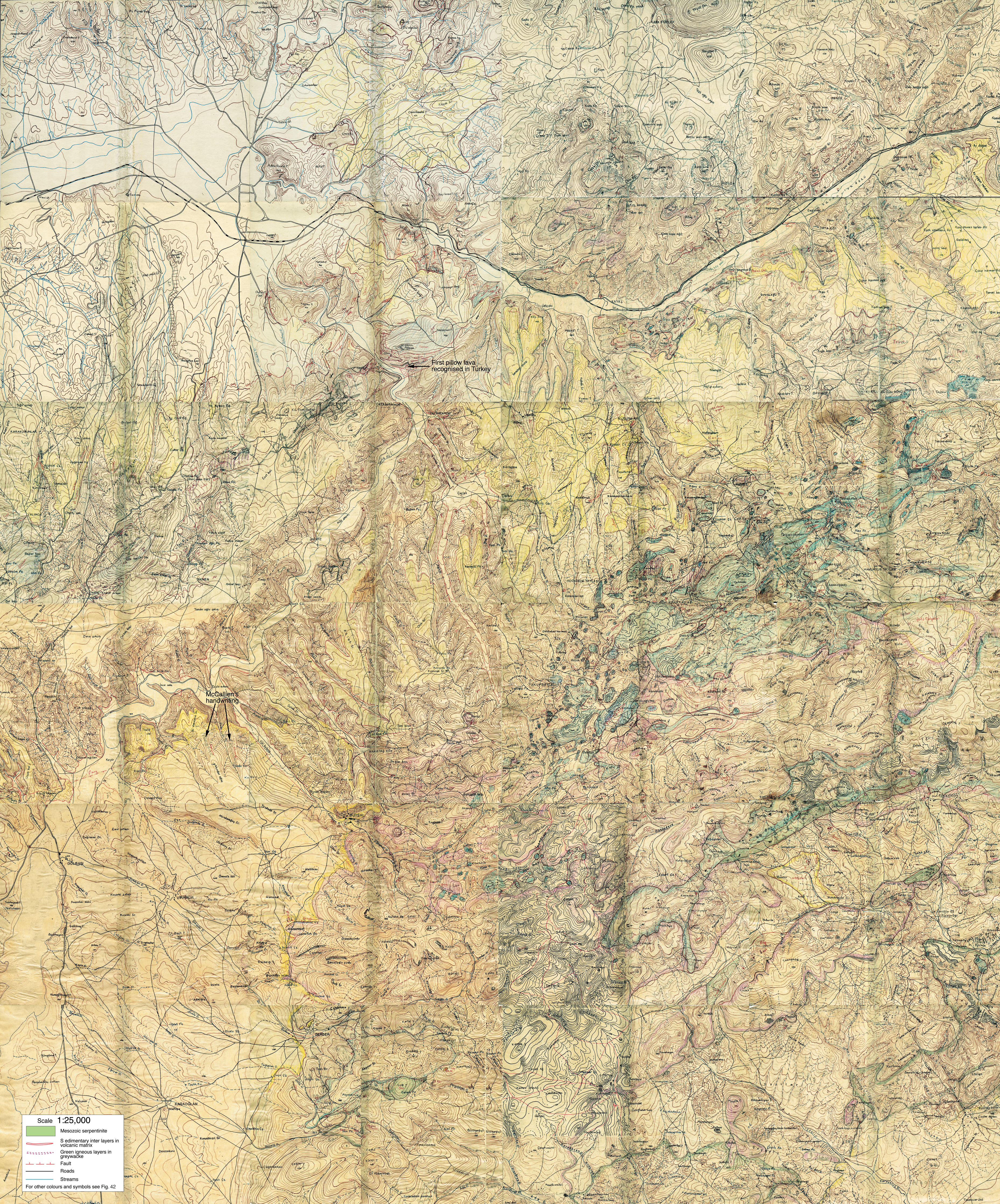
Description:Plate 1. A. Oguz Erol's 1:25,000 geological field map of a part of the Ankara Mélange area. (For location, see Fig. 40.) This map was never properly drafted for publication because no publisher could be found for it. This version is electronically produced by piecing together 24 small field slips, each, in turn, cut in half to enable the bearer to fold them in a rush. This precaution was necessary because it was illegal in Turkey for Erol to possess topographic maps at a scale of 1:25,000 in the late 1940s, under the raging Cold War conditions and a very serious Soviet threat to Turkey. Some omissions at slip boundaries were inevitable owing to previous cutting. The production of this map was not only fine geological workmanship, but also a heroic effort. It represents an invaluable set of data that has not since been duplicated. It is also an international historical monument, as it is the first geological map made at this scale in Turkey, representing one of the earliest maps of a mélange terrain. That terrain became a classic area internationally on the basis of the data gathered for this map. Erol not only colored the map, but also took notes on it in abbreviation in red ink. The following is a list of those abbreviations and their explanation in Turkish and in English. Ag or agl = aglomera = agglomerate; Beyaz lav = white lava; Bl. = Bloklar = block(s) or Blokl. = Bloklar = blocks; Dior. = Diyorit = diorite; Fay = fault; Fillat = phyllite; gr or grevv = grovak = graywacke; Jips = gypsum; Karisik seri = mixed series; Kirmizi = red (refers to young cover; probably late Miocene or Pliocene); Kir. s. = kirmizi seri = red series (refers to a thin, heat-altered horizon under young lavas); küçük bloklar = small blocks; Kumtasi = sandstone; Lav = lava; mikasist = micaschist; Ne kalk. = Neojen kalkeri = Neogene limestone; N or Neoj. = Neojen = Neogene (ince = thin or kalin = thick); Rad = Radyolarit = radiolarite; Tüf = tuff. There are two places on the map where McCalliens handwriting in a faint pencil mark is visible. They are indicated as such.
From:
Sengör, A.M.C., 2003, The repeated rediscovery of mélanges and its implications for the possibility and the role of objective evidence in the scientific enterprise, in Dilek, Y., and Newcomb, S., eds., Ophiolite Concept and the Evolution of Geological Thought: Geological Society of America Special Paper 373, p. 385-445, doi: 10.1130/0-8137-2373-6.385.
Click here to view the entire paper.
Keywords: Map Images (JPG)
JPG Map image file: