
Maps
Geologic Map of the Coso Range
Richard S. Whitmarsh
Data Originator:
J. Douglas Walker
Dept. of Geology, Univ. of Kansas
jdwalker@ukans.edu
doi: 10.1130/1998-whitmarsh-coso
Year: 1998
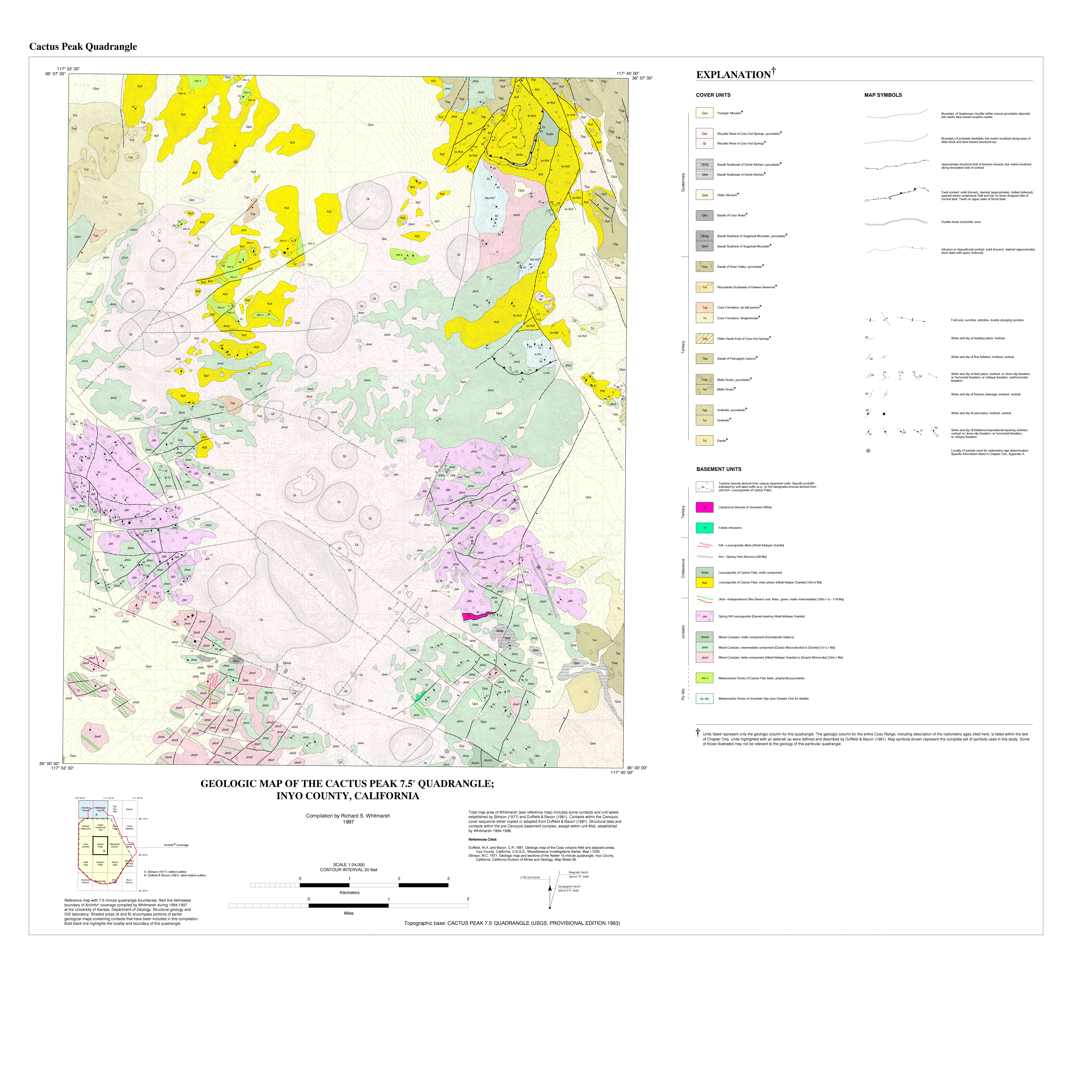
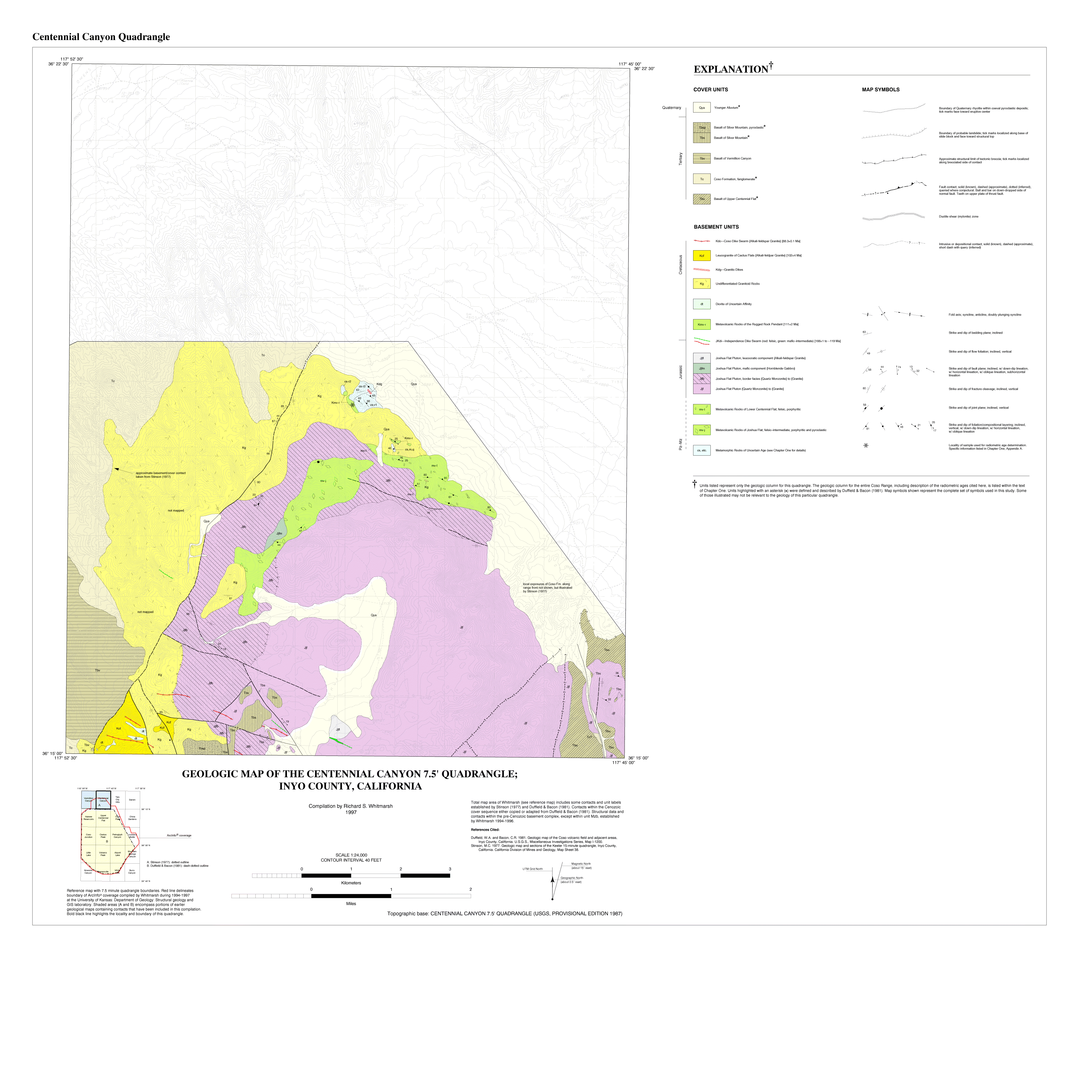
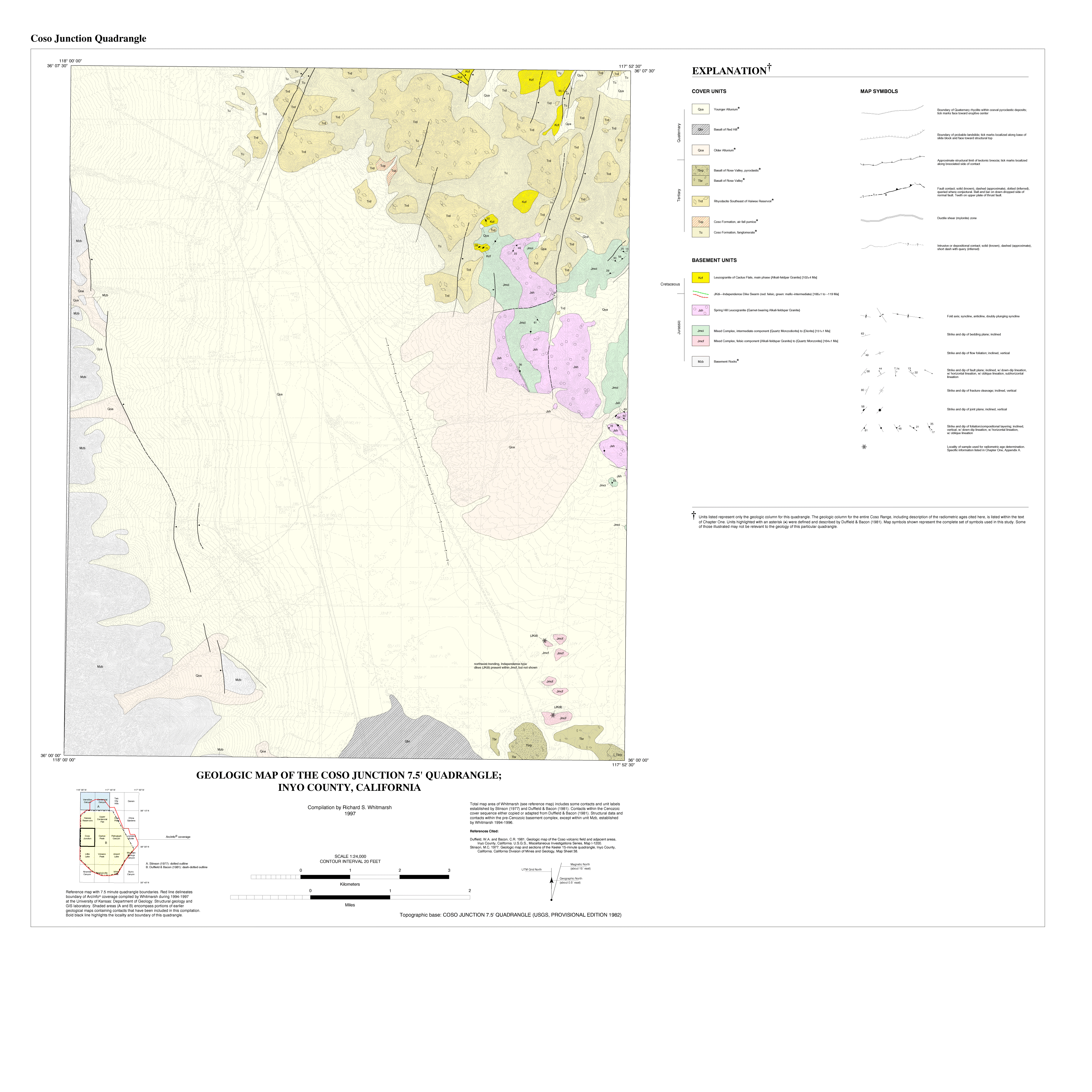
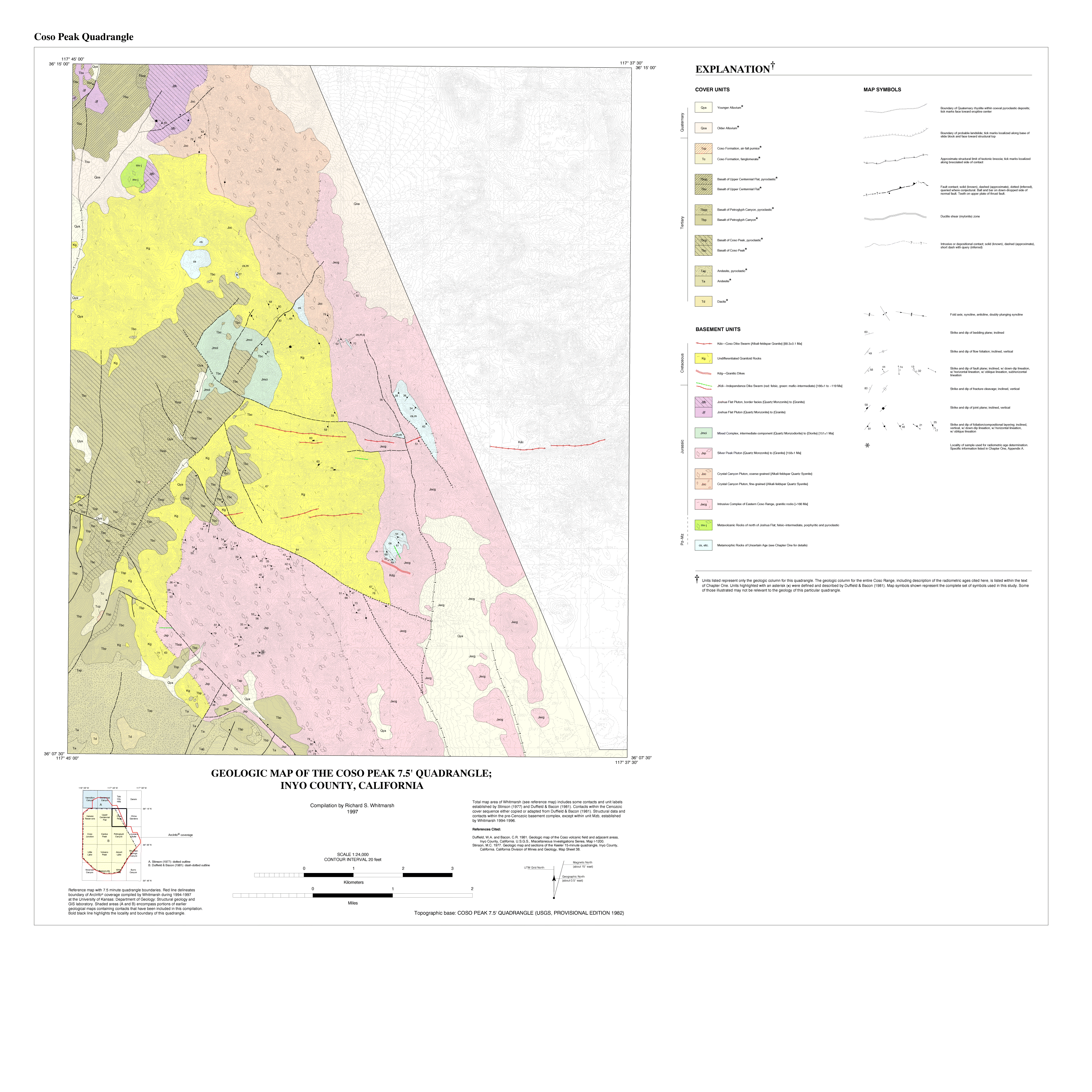
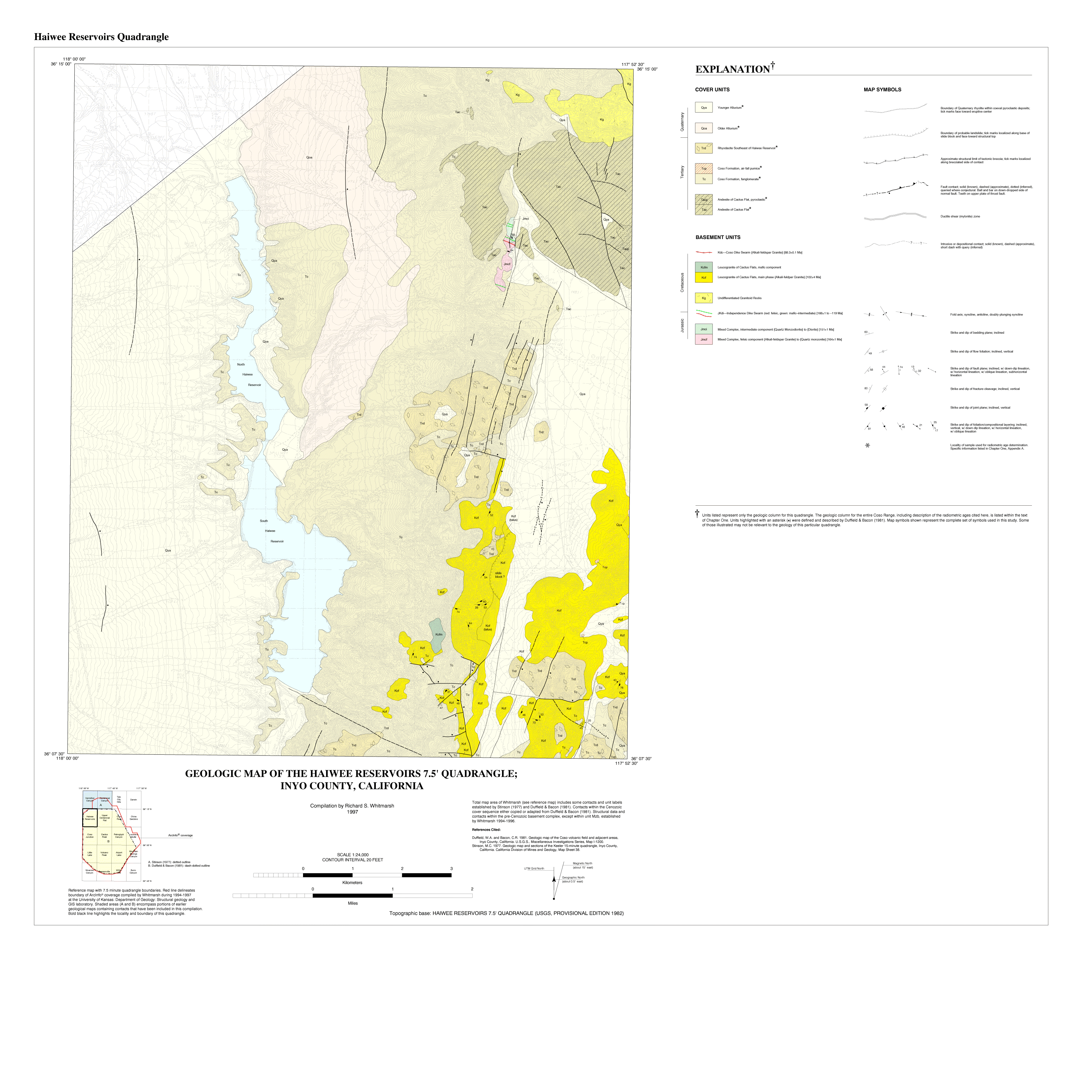
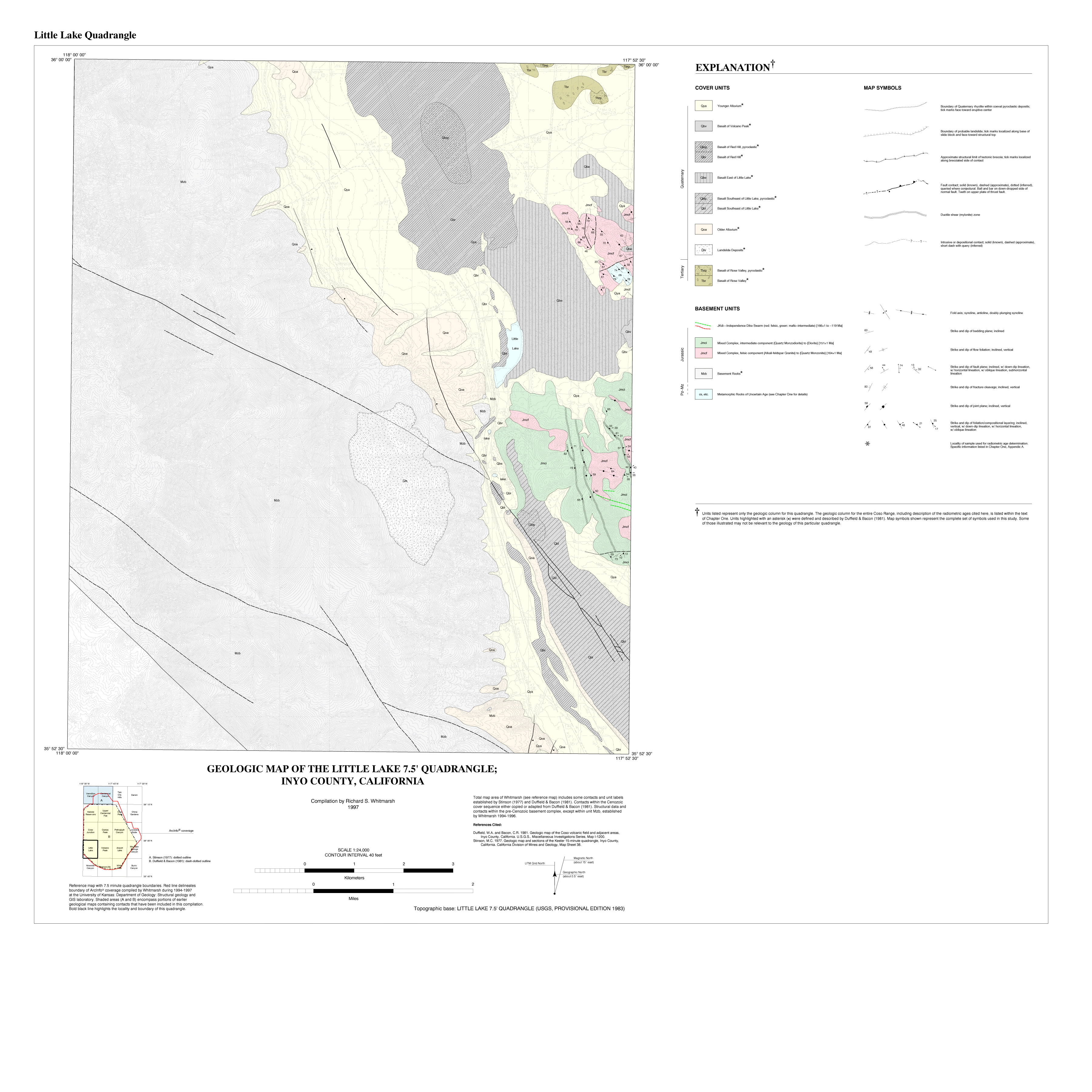
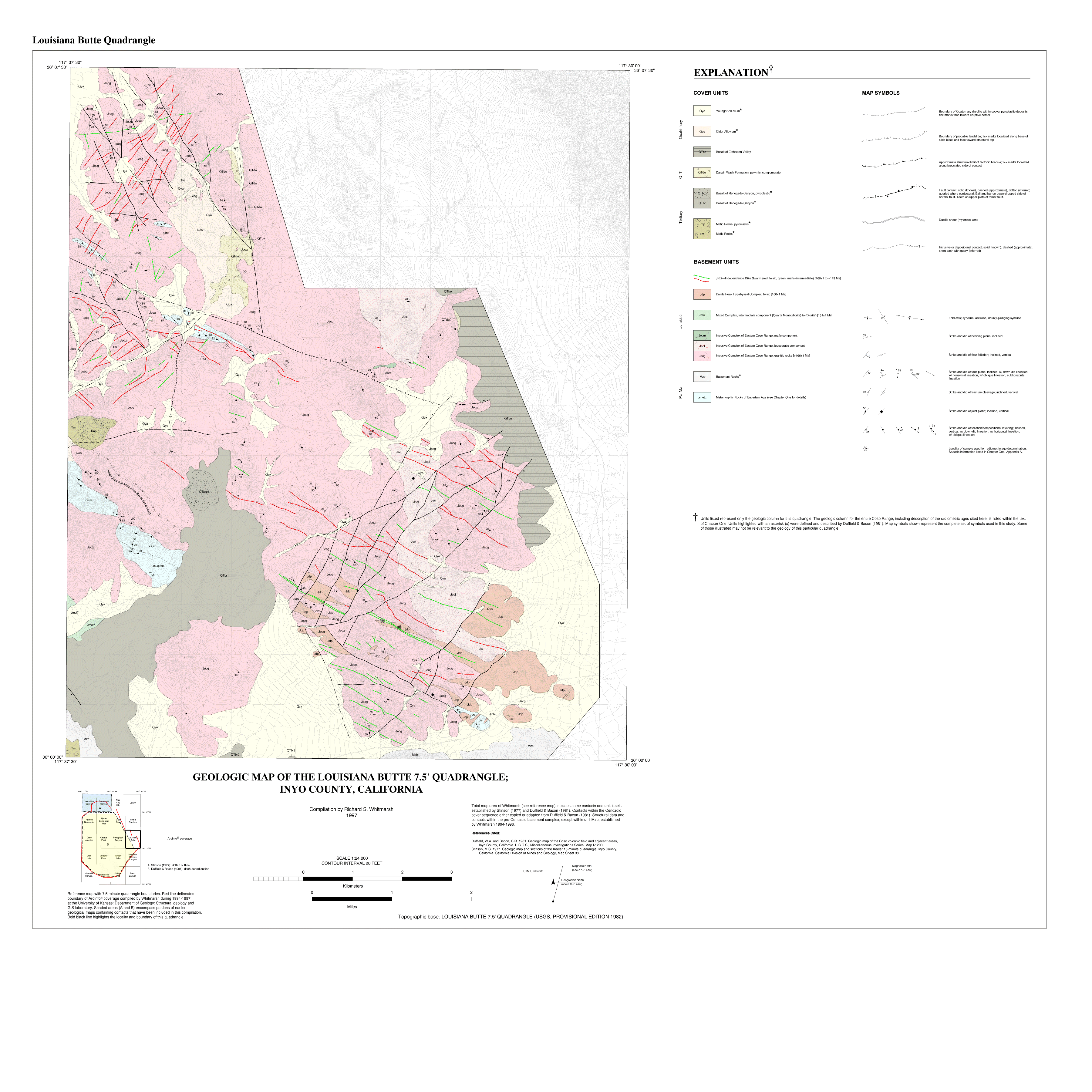
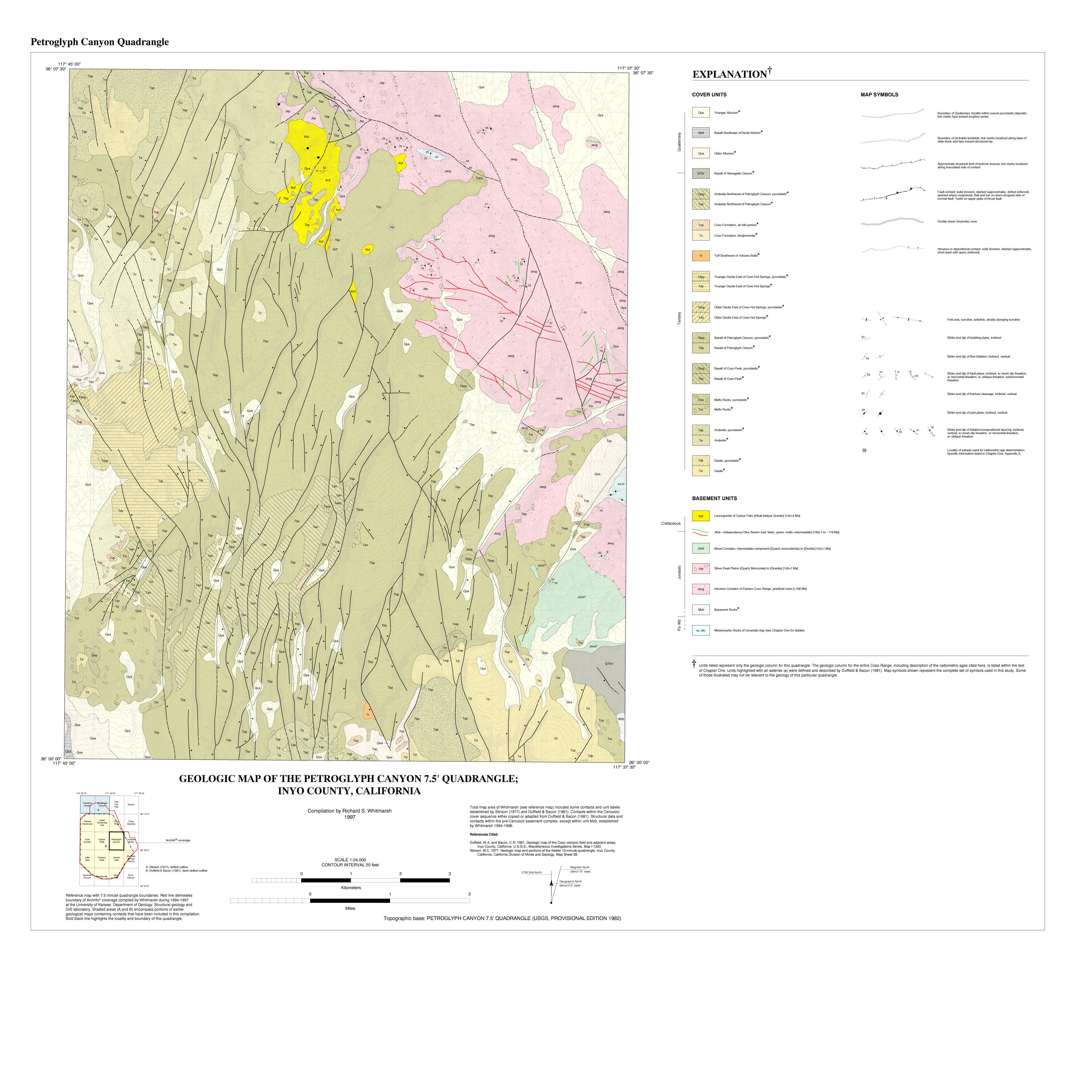
Area: Cactus Peak, Centennial Canyon, Coso Junction, Coso Peak, Haiwee Reservoir, Little Lake, Louisiana Butte, Petroglyph Canyon, Talc City Hills, Upper Centennial Flat, Vermillion Canyon, and Volcano Peak quadrangles
Scale: 1:24,000
Resolution: Variable
Projection
UTM
Parameters: Zone 11, Datum NAD83, Spheroid GRS1980
Units: Meters
Precision: Single
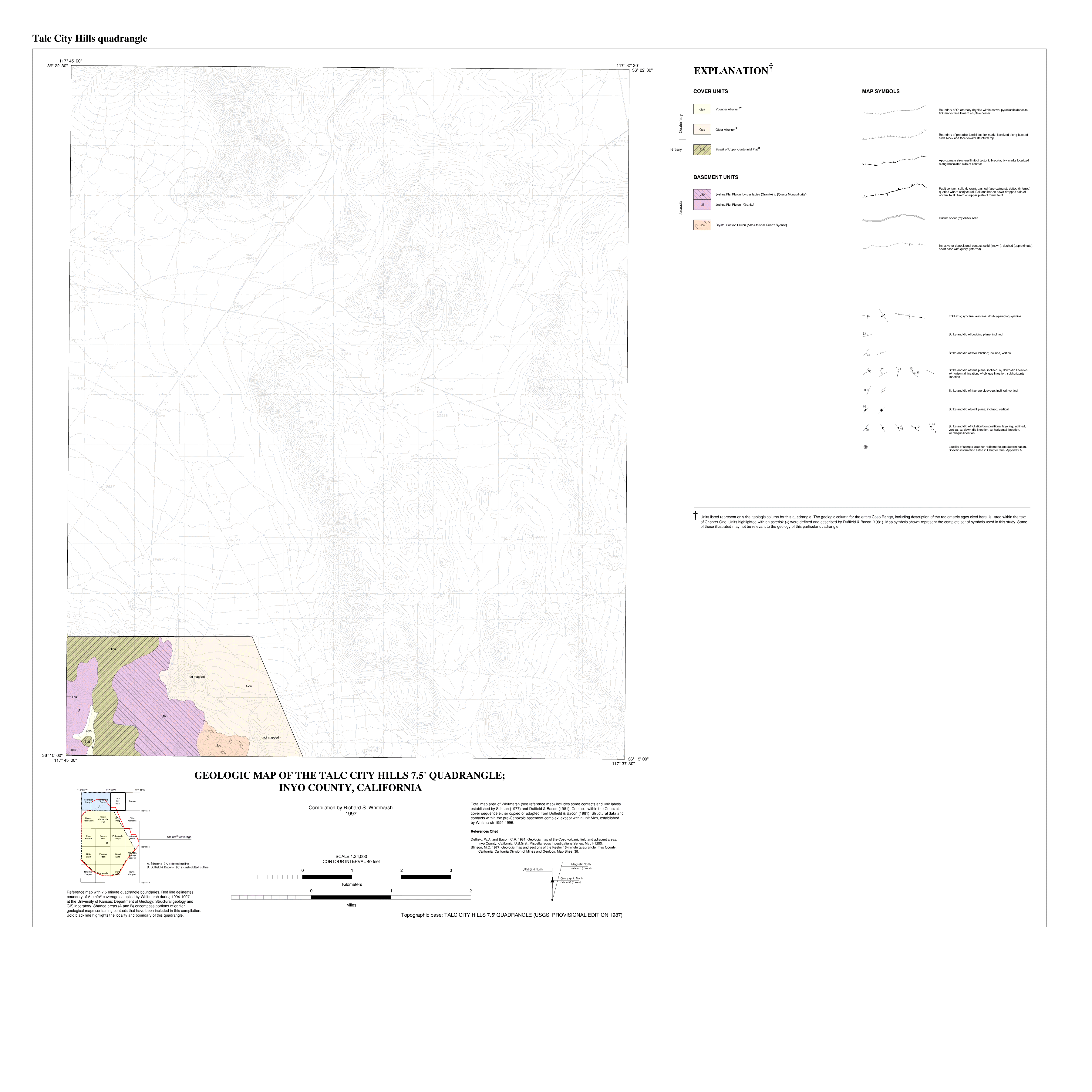
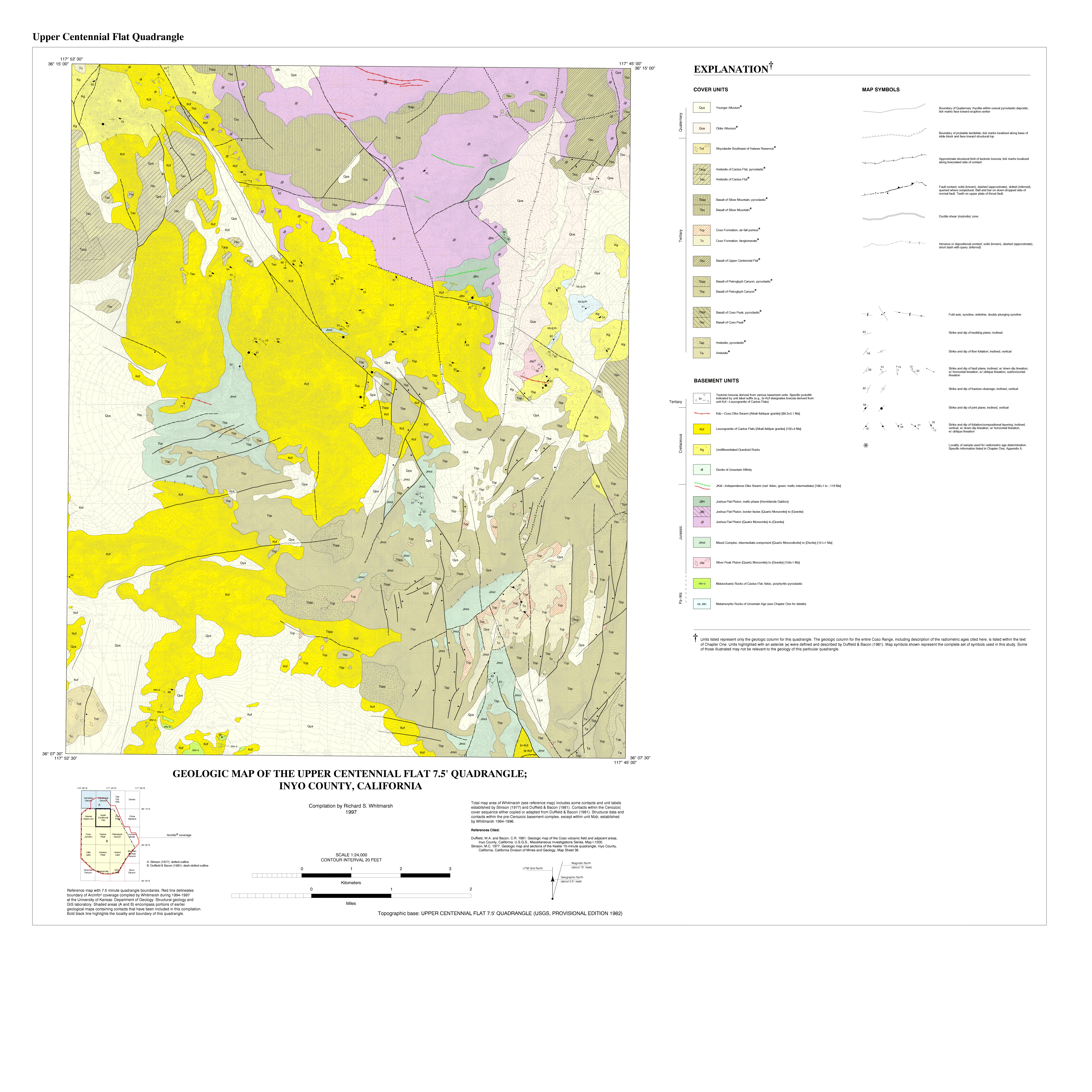
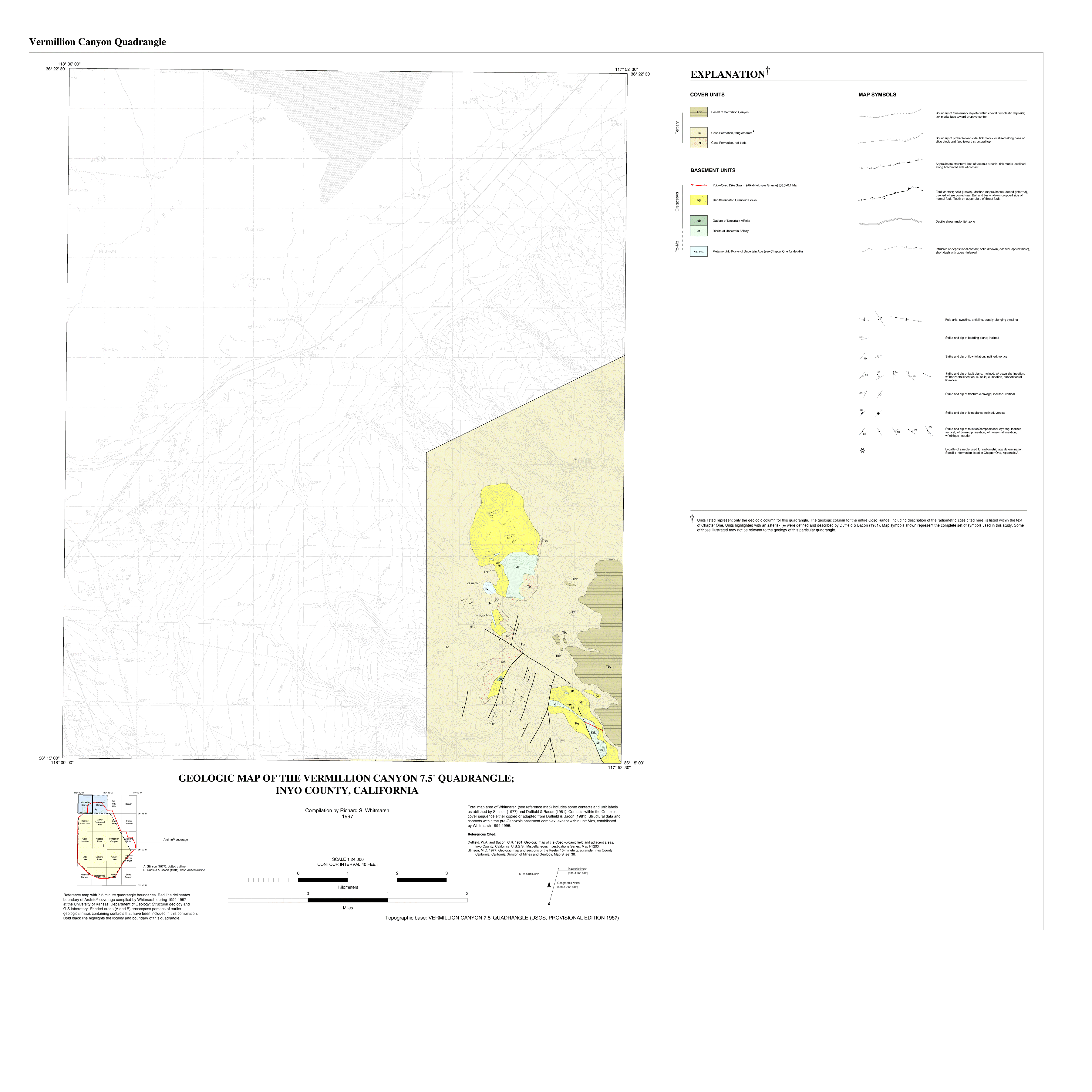
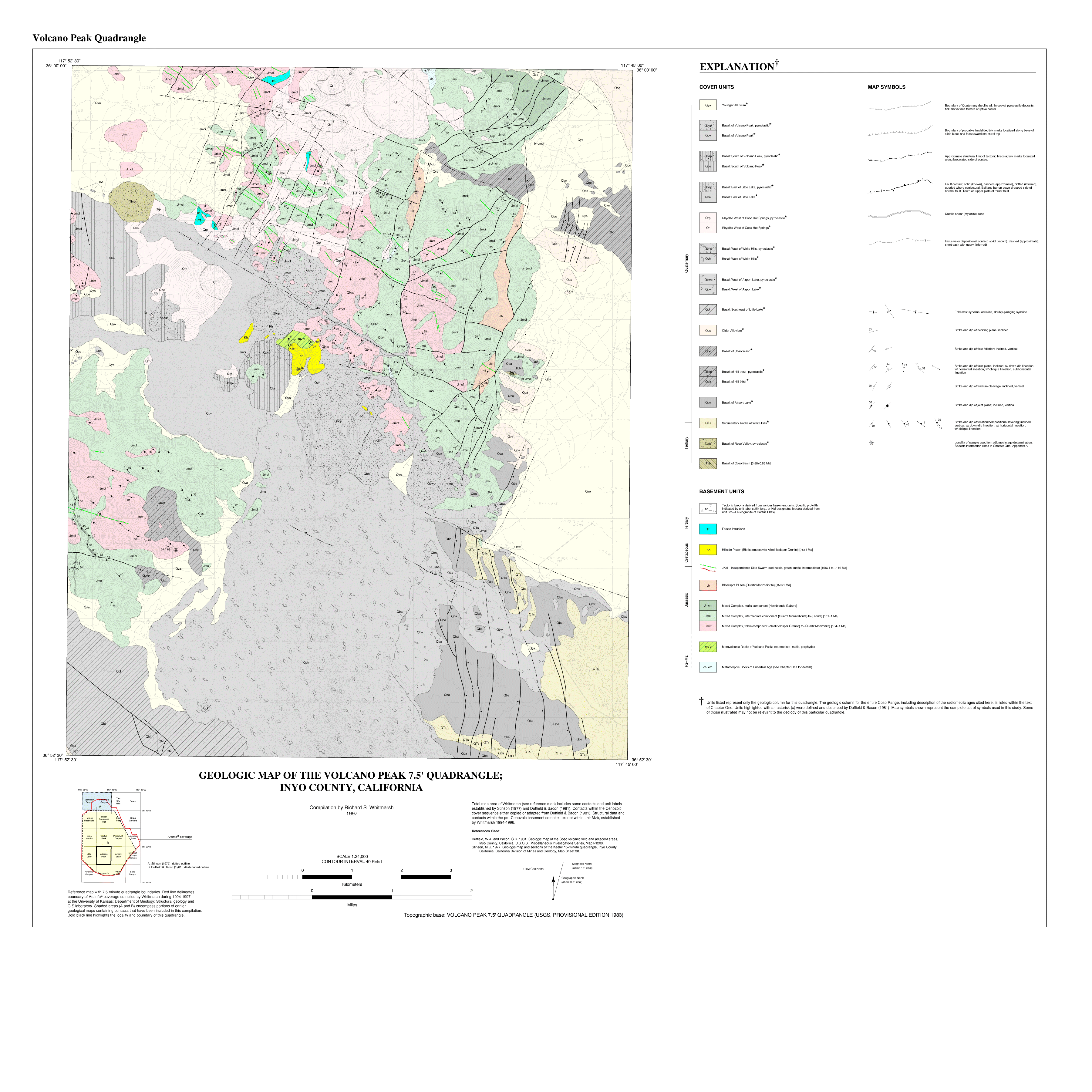
Description: These maps area covers most of the Coso Mountains in east central California. The area is located just south of Owens Lake. The data are partly organized into coverages that correspond to 7 1/2' quadrangles. These are abbreviated in the file names.
Keywords: Coso Range, Whitmarsh, R., Geologic Map, Map Images (GIF, PDF, PostScript)
GIF map image files:
- Cactus Peak
- Centennial Canyon
- Coso Junction
- Coso Peak
- Haiwee Reservoir
- Little Lake
- Louisianna Butte
- Petroglyph Canyon
- Talc City Hills
- Upper Centennial Flat
- Vermillion Canyon
- Volcano Peak
PDF map image files:
- Cactus Peak
- Centennial Canyon
- Coso Junction
- Coso Peak
- Haiwee Reservoir
- Little Lake
- Louisianna Butte
- Petroglyph Canyon
- Talc City Hills
- Upper Centennial Flat
- Vermillion Canyon
- Volcano Peak
PostScript map image files:
- Cactus Peak
- Centennial Canyon
- Coso Junction
- Coso Peak
- Haiwee Reservoir
- Little Lake
- Louisianna Butte
- Petroglyph Canyon
- Talc City Hills
- Upper Centennial Flat
- Vermillion Canyon
- Volcano Peak
Geograpic Information System (GIS) files:
What is GIS?