
Maps
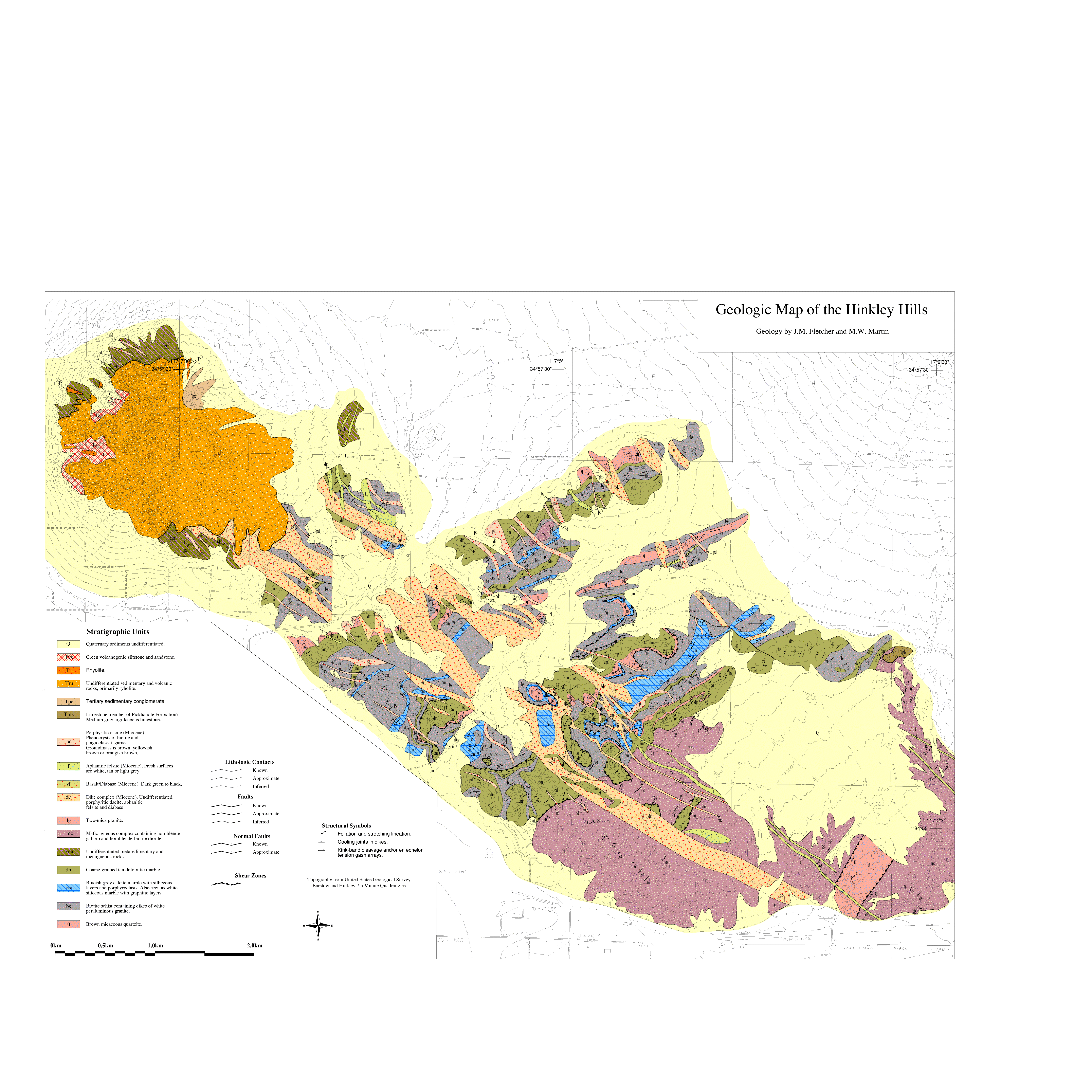
Geologic Map of the Hinkley Hills
John Fletcher and Mark Martin
Data Originator:
J. Douglas Walker
Dept. of Geology, Univ. of Kansas
jdwalker@ukans.edu
doi: 10.1130/1998-fletcher-hinkleyhills
Year: 1998
Area: Barstow and Hinkley Hills Quadrangles, S. California
Scale: 1:12,000
Resolution: Variable
Projection
UTM
Parameters: Zone 11, Datum NAD83, Spheroid GRS1980
Units: Meters
Precision: Single
Description: This map represents the geology of area of The Hinkley Hills, within the Central Mojave Core Complex in southern California. Data include the geology of the area and features from the topographic maps for the area. These topographic data files were created by vectorizing scans of the 1:24,000 scale USGS quadrangle maps for the area. The Hinkley Hills Quadrangle and a very small portion of the Barstow Quadrangle were included. Geologic data are fully attributed. Topography contains only unattributed data, since the USGS DLG data was not yet available for this area.
Keywords: Fletcher, J.M., Hinkley Hills, Geologic Map, Map Images (PDF, PNG, PostScript)
Map image files:
Geograpic Information System (GIS) files:
What is GIS?