
Maps
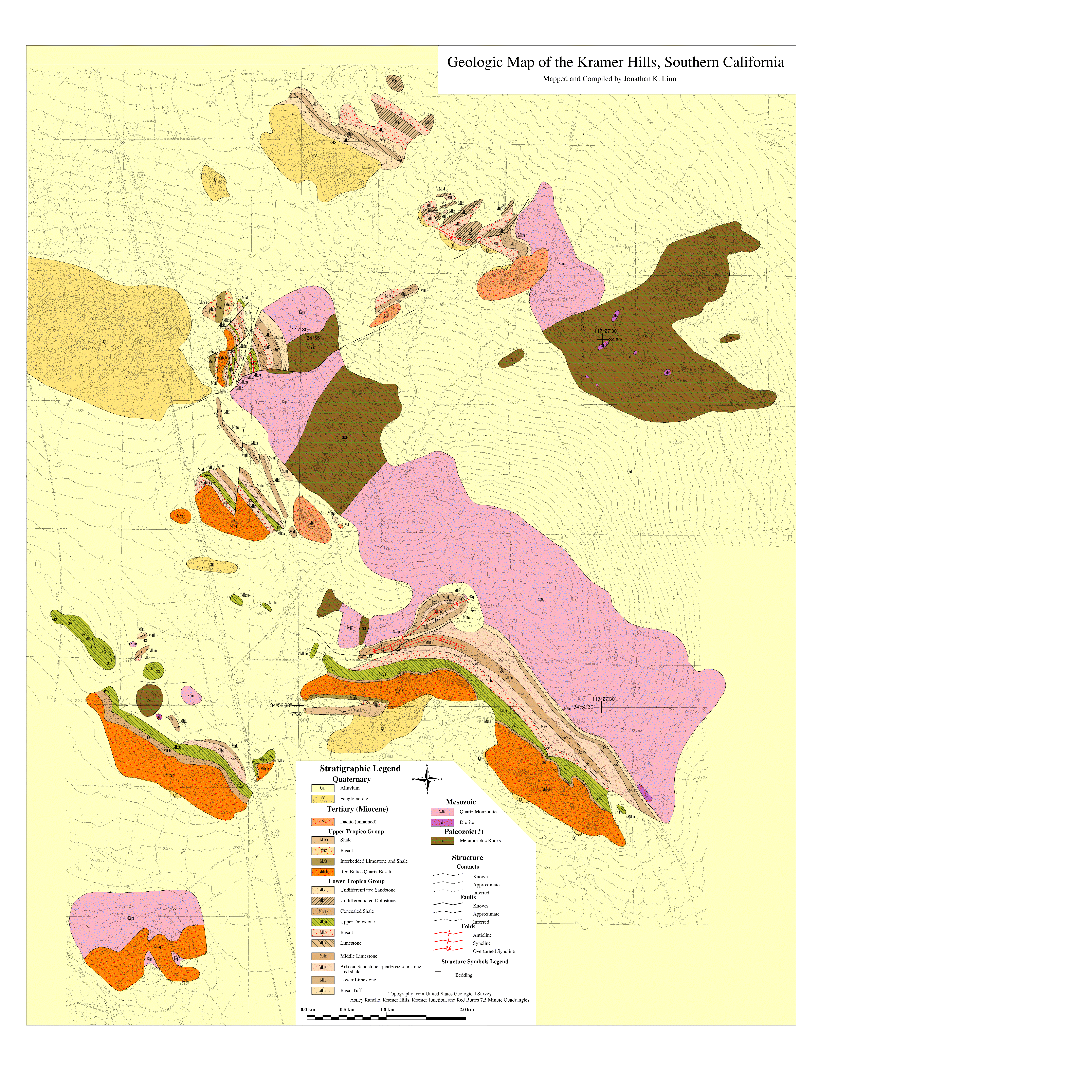
Geologic Map of Kramer Hills
Johnathan K. Linn
Data Originator:
J. Douglas Walker
Dept. of Geology, Univ. of Kansas
jdwalker@ukans.edu
doi: 10.1130/1992-linn-kramerhills
Year: 1992
Area: Astley Rancho, Kramer Hills, Kramer Junction, and Red Buttes Quadrangles, S. California
Scale: 1:15,000
Resolution: Variable
Projection
UTM
Parameters: Zone 11, Datum NAD83, Spheroid GRS1980
Units: Meters
Precision: Single
Description:
Keywords: Linn, J.K., Kramer Hills, Geologic Map, Map Images (PDF, PNG, Postscript)
Map image files:
Geograpic Information System (GIS) files:
What is GIS?