
Maps
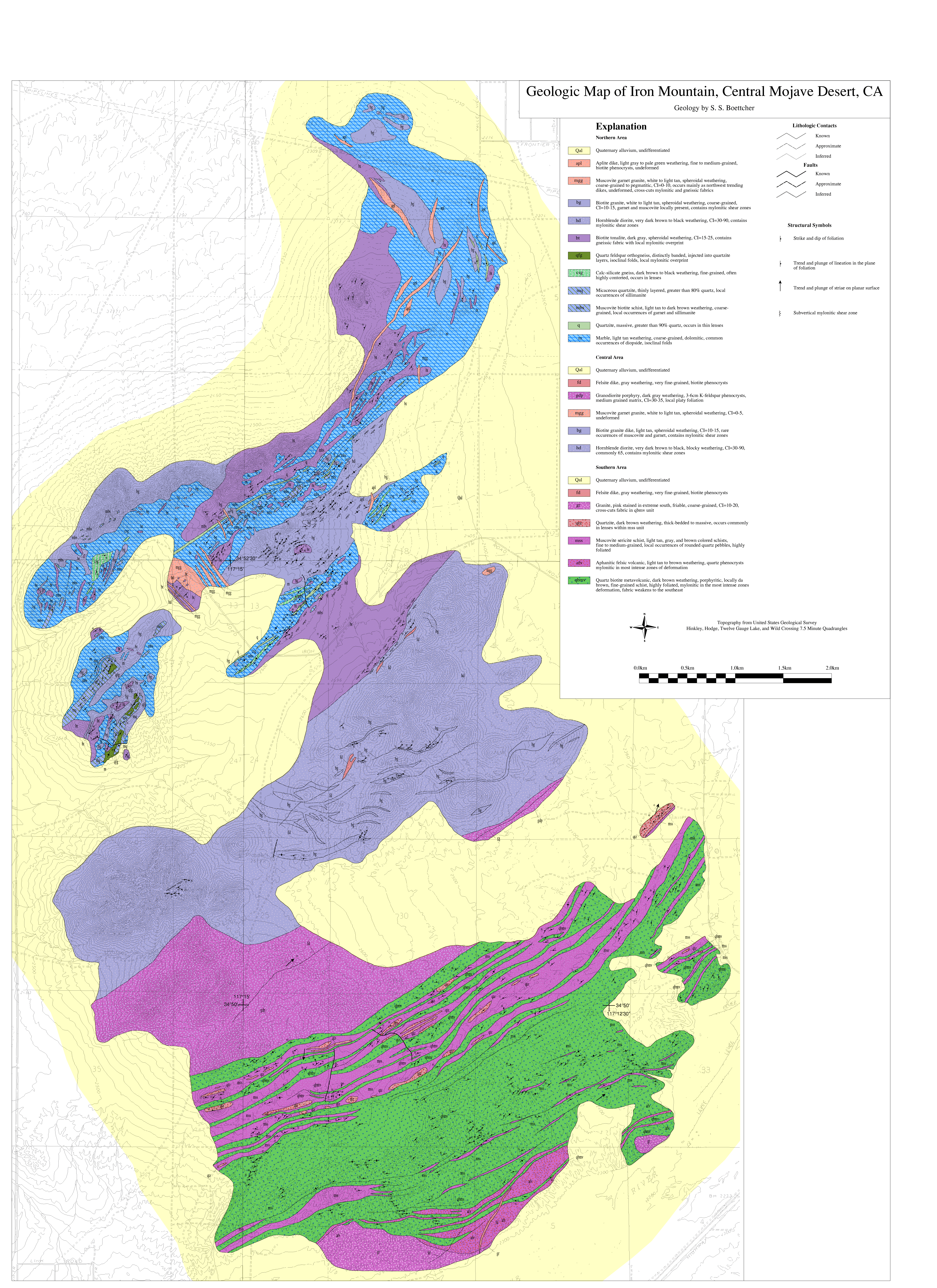
Geologic Map of Iron Mountain
S.S. Boettcher
Data Originator:
J. Douglas Walker
Dept. of Geology, Univ. of Kansas
jdwalker@ukans.edu
doi: 10.1130/1990-boettcher-ironmountain
Year: 1990
Area: Hinkley Hills, Hodge, Twelve Gauge Lake, and Wild Crossing Quadrangles, S. California
Scale: 1:12,000
Resolution: Variable
Projection
UTM
Parameters: Zone 11, Datum NAD83, Spheroid GRS1980
Units: Meters
Precision: Single
Description:
Keywords: Boettcher, S.S., Iron Mountain, Geologic Map, Map Images (PDF, PNG, PostScript)
Map image files:
Geograpic Information System (GIS) files:
What is GIS?