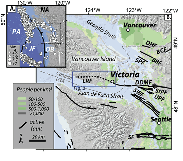
Figure 1.
(A) Tectonic setting. White circles—locations of historical earthquakes (USGS NEIC) between AD 1946 and 2015, scaled by magnitude. White line—boundary between Oregon Block (OB) and North America plate (NA) (McCaffrey et al., 2013; Wells and Simpson, 2001). JF—Juan de Fuca plate; PA—Pacific plate. (B) Population centers (Balk et al., 2006) relative to mapped active faults in black (Sherrod et al., 2008; USGS, 2010; Kelsey et al., 2012; Personius et al., 2014; Barrie and Greene, 2015). The Leech River fault (LRF) is shown as dashed line. BBF—Birch Bay fault; BCF—Boulder Creek–Canyon Creek fault; DDMF—Darrington–Devil’s Mountain fault; DHF—Drayton Harbor fault; SPF—Sandy Point fault; StPF—Strawberry Point fault; SF—Seattle fault; SWF—South Whidbey Island fault; UPF—Utsalady Point fault.