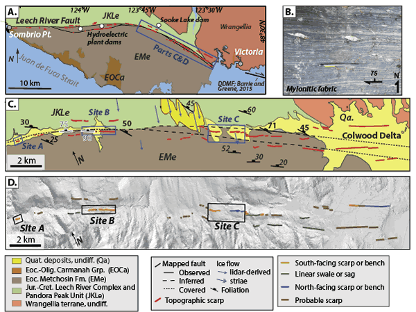
Figure 2.
(A) Simplified geologic map of the Leech River fault and surroundings (after Massey et al., 2005). Red lines denote topographic scarps, pressure ridges, topographic benches, and linear swales and sags identified in this study. See geological legend at base of figure. DDMF—Darrington–Devil’s Mountain fault. (B) Mylonitic fabrics within the Leech River Complex near its contact with the Metchosin Fm. (C) Map showing trace of identified features relative to bedrock (Massey et al., 2005), surficial deposits (Blyth and Rutter, 1993), and local ice flow indicators (blue arrows, this study). Foliation measurements from this study are shown in bold and those from Muller (1983) are shown in italics. Foliation data outlined in white are at the lithologic contact (this study). (D) Fault traces as in part C, colored according to facing direction and feature type, draped on LiDAR hillshade image.