
Page 8 - i1052-5173-26-8
P. 8
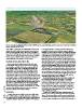
Figure 4. Ammonite from Semington, Wiltshire, England. ©2010 Google Inc. Image GetMapping plc. Online version can be rotated, and is available at
                         http://dx.doi.org/10.1130/GSATG257.S5.

GSA TODAY | AUGUST 2016  vertical sliders. A web-based virtual globe hides irrelevant menu    to compete with onsite, we need to give students control over
                         options that could be distracting to wanderlust-prone students       manipulable virtual specimens. Students engaged in physical
                         and is accessible via mobile devices. Web-based presentation is      fieldwork can also benefit, for example, by creating and uploading
                         important for building large searchable databases of virtual speci-  models for their instructors or peers to help identify. Smartphone
                         mens in the future. Because HTML, KML, COLLADA, and glTF             technology opens up the possibility of data collection by non-
                         files are human-readable (not binary computer code), tags in         professional citizen scientists. Crowd-sourcing in geoscience
                         multiple languages can be added for search purposes.                 (Whitmeyer and De Paor, 2014) has been limited by the need for
                                                                                              advanced skills, however, citizens can create 3D models and share
                         CHANGING VIRTUAL ROCKS WITH TIME                                     them with remote experts. In Project Mosul (2016), archaeologists
                                                                                              virtually rebuilt artifacts destroyed by ISIS militants using crowd-
                           Many undergraduate students have great difficulty under-           sourced tourist photographs. That project has extended to include
                         standing length and time scales of rock formation and change         virtual reconstruction of Katmandu’s cultural sites following the
                         (Kortz and Murray, 2009). Virtual rocks can potentially help         2015 earthquake. Geoscientists with access to vulnerable sites can
                         them visualize changes such as weathering, deformation, and          build image collections in advance of potential destructive events
                         metamorphism. For example, the KMZ downloads include a               such as earthquakes, fires, floods, etc. (e.g., Ure, 2015). Instructors
                         Google Earth view of New England with an emergent crustal            can ask every student in a class to take a cellphone photo of a spec-
                         block that is raised 20 km revealing the depth of garnet grade       imen or outcrop from a variety of angles and build a model to
                         metamorphism. Students can zoom into the block’s base and find       which all students feel they have contributed.
                         a virtual rock in which virtual garnet crystals grow with time. The
                         speed of the simulation can be controlled using the Google Earth       Another justification for virtual rocks is their potential use in
                         time slider. Ultra-slow animations spanning a three-hour lab or a    peer review of manuscripts whose analyses and conclusions
                         three-month course, during which a specimen’s location, shape, or    depend critically on the correct identification of specimens.
                         appearance is gradually modified, may help convey geological         Reviewers currently rely on authors to interpret rocks. In future,
                         scales of space and time. This offers the possibility of viewing     they could ask to see 3D models—a more realistic request than
                         models of weathering, deformation, metamorphism, etc., in what       having rocks mailed to them overland. Authors could embed
                         may feel to students like geological time, because it is so slow     virtual specimens in 3D PDF or HTML5 files as supplementary
                         compared to the pace of their digital lifestyles.                    documents accompanying publications. As one anonymous
                                                                                              reviewer of this paper wrote,
                         DISCUSSION
                                                                                                “I would not be surprised if in future, journals required 3D
                           Computer-generated 3D models of rocks cannot fully replace         representations of outcrops and samples used within their publi-
                         their veriliths, but they can significantly enhance online geosci-   cations. The ability to tag these with locations in a publicly avail-
                         ence education and extend the range of rocks to which both onsite    able dataset could revolutionize structural geology and tectonics
                         and distance education students are exposed. If online classes are   research. Imagine investigating a new field area and being able to

8