
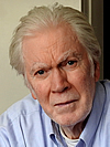
Kristján Sæmundsson
ÍSOR - Iceland GeoSurvey
2018 GSA Florence Bascom Geologic Mapping Award
Presented to Kristján Sæmundsson
Citation by Barry Voight
Indisputably one of the world’s premier field geologists, Kristján Saemundsson worked for over a half-century with the geoscience division of the Iceland GeoSurvey (ÍSOR) and its predecessor, the National Energy Authority (NEA). There he led immense geological mapping programs and studies of geothermal areas. Besides the monumental achievement of mapping the entire country, he and close colleagues produced detailed regional investigations and unexcelled maps and studies of the major central volcano systems such as Hengill, Krafla, and the massive rhyolite system Torfajökull. He extensively advanced both understanding of Iceland’s geologic evolution as a whole, as well as the details of individual volcanic systems in Iceland, directly relevant for our general understanding of how volcanoes work.
When he began his work in 1961, the relation of Iceland to sea-floor spreading was problematic, and plate tectonics had not yet been invented. Kristján’s mapping resolved the key obstacles and demonstrated that the active rifting zones in Iceland had shifted and were linked by complex transforms to the mid-ocean spreading ridge. His deconvolution of the complex geologic processes shaping the largest subaerial part of the Mid-Oceanic Ridge system in Iceland forms the basis of our present-day understanding of this critical natural laboratory for spreading processes and its continued relevance to global mid-ocean-spreading research.
Further, his insights and vast geological and tectonic knowledge on both high- and low-temperature geothermal areas in Iceland yielded a major increase in knowledge of geothermal systems, and probably no one has contributed more than he to Icelandic energy developments that transformed the standard of living of his nation. Geophysicist Ólafur Flóvenz, a long-time colleague and now chief of ÍSOR, has expressed his impact concisely: “Kristján Sæmundsson is in my mind the main author of the modern understanding of the geology of Iceland and has contributed more to it than any other. Same applies to the geothermal sector, no single person in Iceland has contributed more to the successful geothermal development of Iceland than Kristján.”
His legacy is comprised by his numerous superb maps on a variety of scales, his high quality papers and impactful ideas that have impacted scientific thought and significant energy development, and the generations of people he inspired with his knowledge and generous attitude. The 2018 Florence Bascom Geologic Mapping Award of the Geological Society of America could not be in better hands!
2018 GSA Florence Bascom Geologic Mapping Award — Response by Kristján Sæmundsson
I am honored to receive this award from the Geological Society of America that so well emphasizes the importance of basic field mapping in solving scientific and practical problems.
I've been mapping for a long time now, mostly in Iceland. The pleasure of finding things out in the field has been rewarding enough — but this society’s honor is icing on the cake. I have had many field mapping geologists as colleagues on projects at the Iceland GeoSurvey, and important contributions came from others at different institutions. It is on their behalf too that I accept this award.
I recall fondly my first geological mapping experience in the early 1960s, concerning Hengill, a volcanic center in Iceland's Western volcanic zone. I was one of several grad students mentored in Iceland projects by Prof. Martin Schwarzbach, a noted climatologist and Professor of Geology at the University of Cologne.
I was fortunate at that time to find support from the National Energy Authority of Iceland. There, Jón Jónsson, geologist-in-chief of its Geothermal Department, and two successive directors acted as true benefactors by involving me into a branch of geology which occupied me lifelong. One was Gunnar Bödvarsson, who approved the idea that I undertake geological mapping of Hengill, host of a major geothermal resource. Its geology is dominated by numerous subglacial fissure eruptions that formed elongated piles of broken rock rather than sheets. Typically such deposits had been collectively lumped on maps as hyaloclastite, but they proved to be mappable units which could be subdivided into groups in a distinct time sequence, and feeder dykes exposed in their basement proved their individuality as fissure eruptions.
The second was Guðmundur Palmason, who in a liberal way allowed me to collect mapping experience in various terranes. This was of vital importance in dealing with low to medium temperature geothermal systems which today supply almost 90% of our cold country's population with hot water for domestic use. The first project concerned a thermal area in the Tertiary of West Iceland. Mapping of the topmost 1000 m of this lava pile was completed in collaboration with a colleague and keen observer, Horst Noll from Cologne University. It included an exhumed central volcano radiometrically dated as of Pliocene age with eight glacial horizons spaced regularly at 100 m intervals from 3.1 to 2.4 MY. The idea of a periodic occurrence of glacial intervals popped up, then too novel for most, but slumbering in my mind ever since.
This was followed up by large magnetostratigraphic and dating studies in West and North Iceland in the late 1970s, with Norman Watkins and Ian McDougall providing geomagnetic and dating expertise. Dating by Jim Aronson settled my suggestion put forward in the late 1960s that regional anticlines and synclines in the Tertiary of Iceland were due to rift jumps rather than folding. Other structural problems in the geology of Iceland were worked on in collaboration with competent experts such as Barry Voight and Jeffrey Karson.
My professional career was really in the field of geothermal exploration and exploitation for space heating and energy. One major advance in siting of hot water wells, for instance, was when it was found that dyke swarms of the active volcanic systems extended far beyond their surface expression and produced vertical permeability in rock millions of years older. My work involved extensive geological study of thermal prospects in widely distributed areas, and the information so gathered over the years found its way into general geological maps of Iceland. So large regional mapping projects were pursued, with excellent GeoSurvey colleagues. This mapping led to improved understanding in fitting complex Iceland geology into the schemes of mid-ocean ridge tectonics and sea-floor spreading.
This is a special honor. I cannot begin here in this short speech to thank all the people who have helped me, including my family for putting up with the many days I was off in the field. Sincere thanks go to them all.