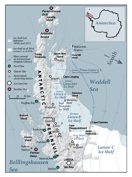
Figure 3.
LARISSA study region and sites of research focus. Geographic features highlighted by circles were areas of detailed investigations or instrumentation in support of regional characteristics. Contours are isotherms of mean annual temperature at sea level; −9 °C has been suggested as the limit of long-term ice-shelf stability in previous studies. Base map provided with permission from XNR/Terra Carta (www.terracarta.com).