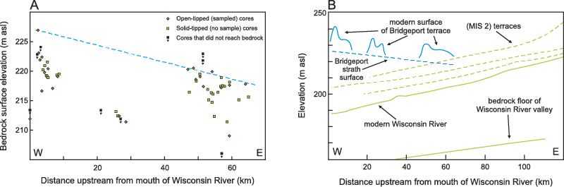
Figure 3.
Results of Geoprobe coring to determine dip of strath surface. (A) Elevation of strath surface at each coring site as a function of distance upstream from the mouth of the Wisconsin River. Trendline (blue dashed line) represents original strath surface, dipping to the east with an estimated slope of 0.15 m/km; asl—above sea level. (B) Bridgeport strath surface as resolved from Geoprobe coring (eastward-dipping blue dashed line) in relation to other major (westward-dipping) surfaces in the lower Wisconsin River valley; modified from Knox and Attig (1988).