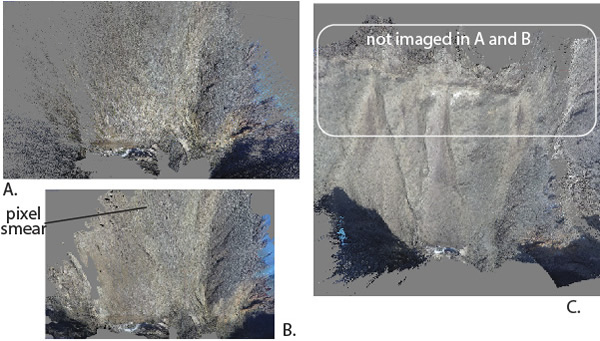
Figure 3.
Illustration of the power of using unmanned aerial system (UAS) imagery in Structure from Motion studies. Figure is a comparison of a near-vertical view of the same area developed using the same camera from ground-based images only (A and B) versus ground-level to ~100 m elevation UAS flight images (C). (A) is a visualization of the colored point cloud, whereas (B) is a textured triangulated irregular network model, and (C) is a colored point cloud with all scenes processed at the same resolution using Agisoft PhotoScan. Seventy images were used in (A) and (B) versus 400 in (C), but the increase in resolution is primarily due to greater ranges of look angles in (C).