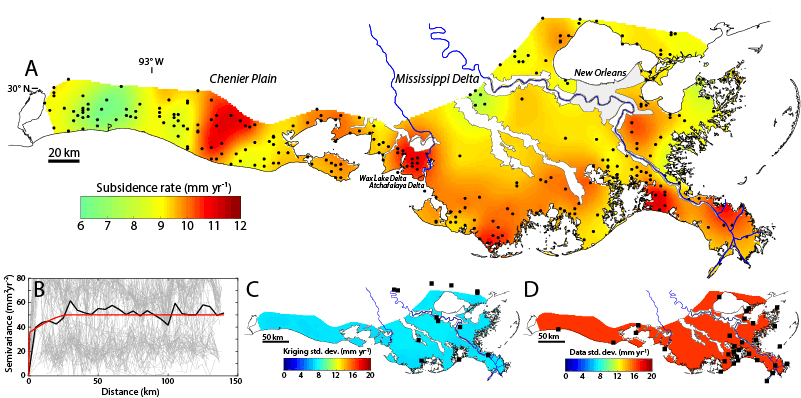
Figure 1.
(A) Subsidence map for coastal Louisiana based on geostatistical interpolation (kriging) of 274 observations (black dots) of land-surface subsidence rates over the past 6–10 years. Areas in white and gray are agricultural and urban, respectively, and located outside of the wetlands. (B) Semivariogram of the data using 100 draws from different kriging options (gray), the data mean (black), and the kriging model (red). (C) Uncertainty (standard deviation) of the kriging estimate. Black squares show GPS stations. (D) Uncertainty (standard deviation) of the underlying data. Black squares show National Oceanic and Atmospheric Administration (NOAA) tide gauges. Note that the subsidence map can easily be converted into a relative sea-level rise map by adding the climate-driven sea-level component.