GSA Today
Volume 29
About the cover:
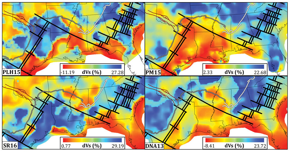
Map view of four recent seismic shear wave models of the southern U.S. at 5 km above the
Moho, plotted as perturbations with respect to the same average 1D model. Solid black lines represent a proposed rift and transform fault system. The southern U.S. has relatively low seismicity compared to western and northeastern North America, so few local earthquakes are available for imaging, and there have historically been few seismic stations to record distant earthquakes as well. These results were made possible by EarthScope’s Transportable Array. See related article, p. 4–10.
doi: 10.1130/GSATG387A.1
© The Geological Society of America, Inc.