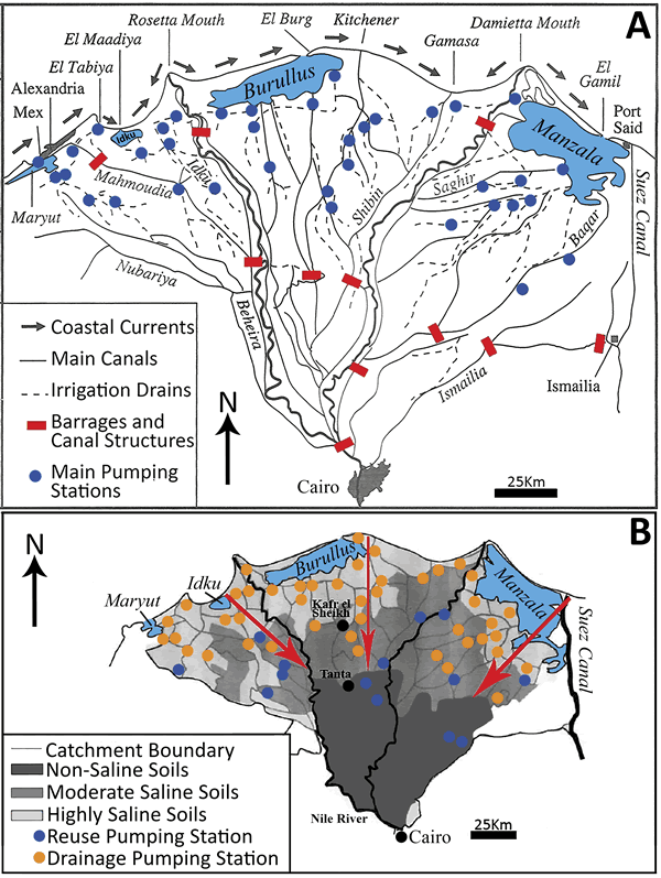
Figure 5.
(A) Map of geographic features and network of major canals, drains, and pumping stations in the Nile delta (modified after Sestini, 1992); arrows at coast show dominant east-directed wave-driven current flow (after various authors). (B) Map of delta soil salinities (non-saline = <1000 ppm; moderate-mixed saline = 1000–35,000 ppm; highly saline = 35,000 ppm), highlighting the southward progressing saline intrusion (modified after Sefelnasr and Sherif, 2014).