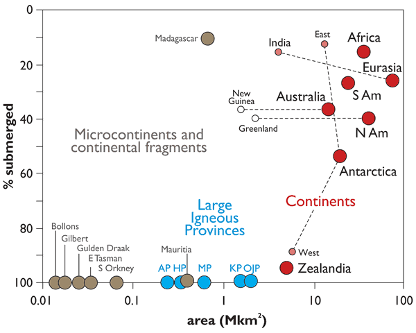
Figure 4.
Areas and submergence of all of Earth’s geological continents (red symbols) along with microcontinents (brown symbols) and intraoceanic large igneous provinces (LIPs, blue symbols) shown in Figures 1 and 2. Note x-axis is log scale. Data mainly after Cogley (1984) except Zealandia data from Mortimer and Campbell (2014); microcontinents after Gaina et al. (2003) and Torsvik et al. (2013). Emergent land area for Antarctica is the isostatically-corrected ice-free bedrock surface from Jamieson et al. (2014). New Guinea and Greenland are arbitrarily given the same submergence value as their parent continents. AP—Agulhas Plateau; KP—Kerguelen Plateau; OJP—Ontong Java Plateau; MP—Manihiki Plateau; HP—Hikurangi Plateau; N Am—North America; S Am—South America.