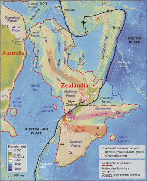
Figure 2.
Spatial limits of Zealandia. Base map from Stagpoole (2002) based on data from Smith and Sandwell (1997). Continental basement samples from Suggate et al. (1978), Beggs et al. (1990), Tulloch et al. (1991, 2009), Gamble et al. (1993), McDougall et al. (1994), and Mortimer et al. (1997, 1998, 2006, 2008a, 2008b, 2015). NC—New Caledonia; WTP—West Torres Plateau; CT—Cato Trough; Cf—Chesterfield Islands; L—Lord Howe Island; N—Norfolk Island; K—Kermadec Islands; Ch—Chatham Islands; B—Bounty Islands; An—Antipodes Islands; Au—Auckland Islands; Ca—Campbell Island. Mercator projection.