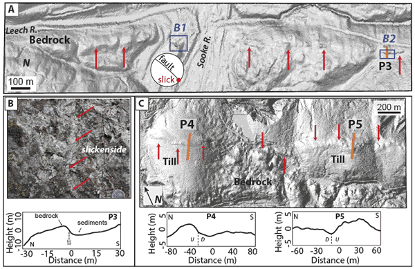
Figure 4.
(A) LiDAR hillshade image for site B where there is a >1.5-km-long scarp in bedrock. Red arrows point to steep face. Stereonet from fault at site B1. (B) Field photo of gouge-bearing fault at site B1, with subhorizontal slickenlines. Elevation profile at bottom for site B2. (C) LiDAR hillshade for site C showing topographic features with opposing facing directions and a morphology suggestive of pressure ridges. Red arrows point to the steep face. LiDAR-derived elevation profiles shown below the image. Because structures are buried beneath dense vegetation and glacial till, fault locations are inferred (dashed lines on the profiles). U and D denote up- and downthrown sides, respectively.