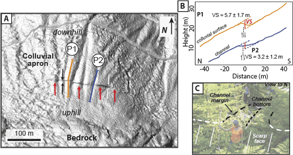
Figure 3.
(A) LiDAR hillshade map of Site A, showing an uphill (south) facing scarp cutting the surface of a steeply north-sloping colluvial apron and channels. Red arrows point to steep face. Black and white arrows show apparent left and right (respectively) lateral separations of channel margins. Example profile lines (P1 and P2) locations shown. Additional profile lines are shown in Figure DR2 (see text footnote 1). (B) An example of LiDAR-derived elevation profiles from interfluve P1 and channel P2. VS—vertical separation. (C) Field photo showing tectonic scarp in a channel at site C.