[next]
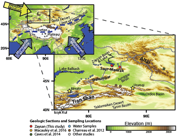
Location map. Inset: yellow arrow—westerly moisture; blue arrows—monsoonal moisture. Dashed blue line—approximate, modern-day inland extent of monsoonal moisture (Araguás-Araguás et al., 1998).