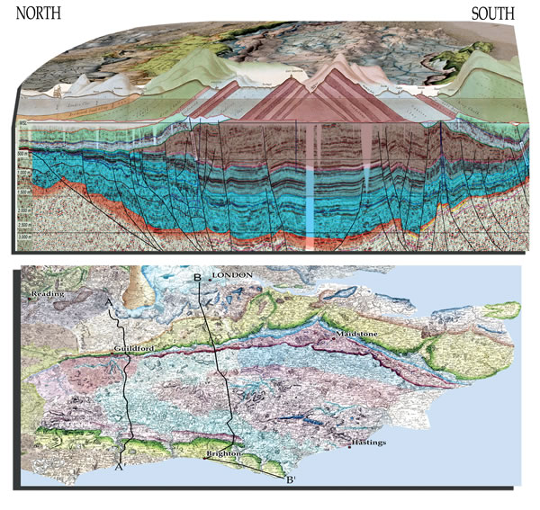
Figure 4.
Part of William Smith’s 1819 Section of the Strata across Surrey and Sussex shown with part of his 1815 map, which has been draped on an SRTM elevation model. Also shown is a modern composite seismic section (modified from Butler and Jamieson, 2013). Green—Chalk; blue-gray—Greensand and Gault; pink-brown—Purbeck-Portland; blue—older Jurassic; orange-brown—Triassic. The locations of the seismic section (A–A´) and Smith’s section (B–B´) are shown on Smith’s county geological maps of Kent, Sussex, and Surrey.