GSA Today
Volume 26, Number 7 (July 2016)
About the cover:
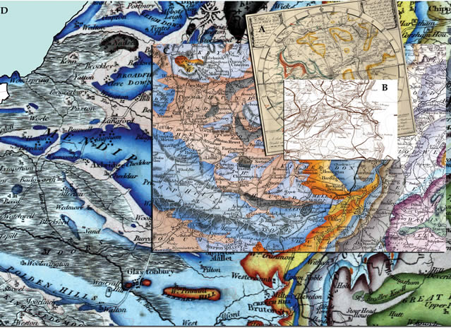
Digital reconstructions of maps of the English county of Somerset used by William Smith in his geologic mapping. (A) Smith’s first geological map around the city of Bath on a base map made by Taylor and Meyler (1799). (B) Part of the Day and Masters (1782) map of Somerset known to have been used by Smith. (C) Smith’s geological map of Somerset based on his engraved geological lines on a map by John Cary. All maps have been re-projected and overlain on part of Smith’s 1815 geological map of England and Wales. (Courtesy Peter Wigley.) See related article, p. 4–10.
© The Geological Society of America, Inc.