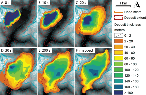
Figure 4.
DAN3D runout simulation of the Sentinel rock avalanche. Panels (A–E) show snapshots of the runout at indicated times. Thickness at 200 s represents final modeled values and has been bulked by 28% for comparison with mapped and reconstructed values (F). See the GSA Supplement Data Repository (see footnote 1) for animation. Shaded relief map and 30 m contours show recreated sliding surface topography. Thickness values <2 m have been omitted for clarity.