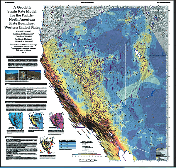
Figure 12.
Geodetic strain in part of the western United States, information that is used, along with seismic and neotectonic data, in earthquake-hazard assessment and communication of hazard information to the public (warmer colors and longer arrows illustrate areas of relatively higher strain; figure from Kreemer et al., 2012). A full-size copy of this map is available at http://pubs.nbmg.unr.edu/Geod-strain-rate-full-size-p/m178.htm.