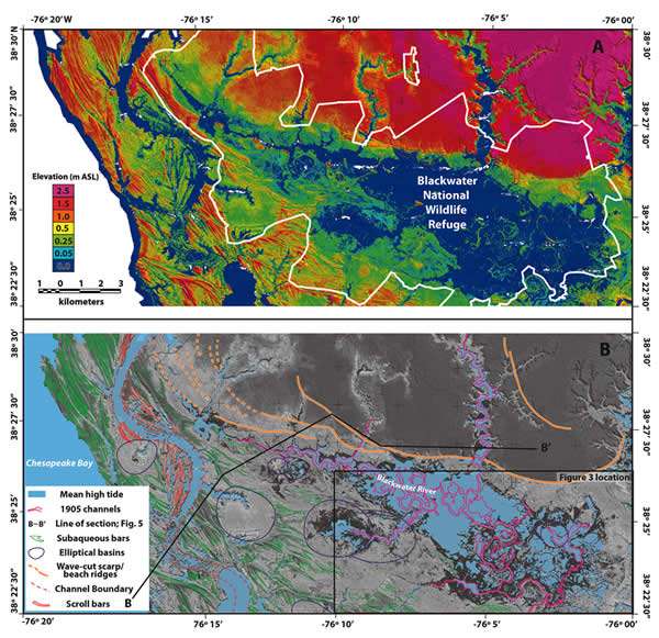
Figure 4.
(A) LiDAR-derived digital elevation model (DEM) of the Blackwater National Wildlife Refuge projected with the NAD83 datum; produced by H. Pierce (2012, pers. comm.); m ASL—meters above sea level. Cell size is 2.5 m by 2.5 m; graduated elevation scale indicated to the left of the image exaggerates subtle features in the lowest elevation ranges. White outline indicates boundary of the Blackwater National Wildlife Refuge. (B) Same LiDAR DEM as (A) in gray-scale with geomorphic features referenced in the text superimposed. AD 1905 channel margins were digitized from the topographic map in Figure 3A.