GSA Today
Volume 25, Number 8 (August 2015)
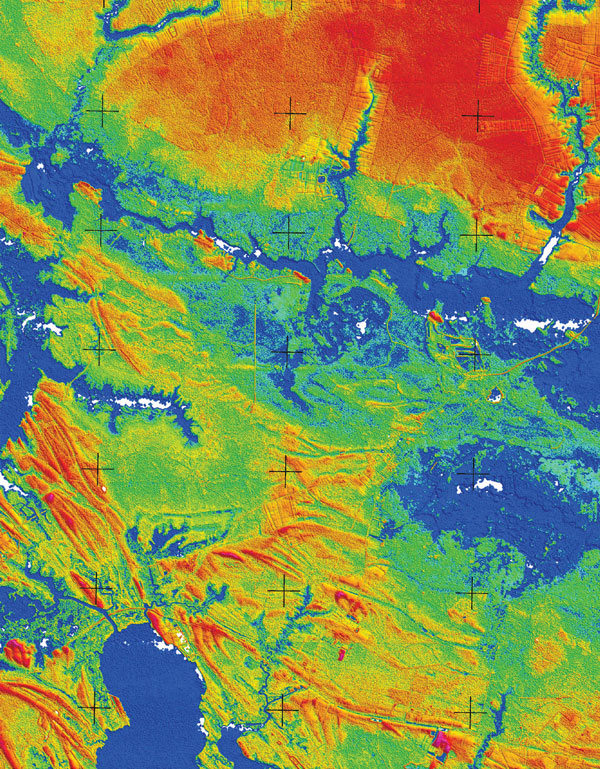
About the cover:
LiDAR-based mapping shows emergent estuarine sand bars along the shore of Chesapeake Bay. DeJong et al. show this landscape formed when sea level was >40 m lower than today. Its present elevation suggests that high rates of relative sea-level rise will continue in the mid-Atlantic region for the foreseeable future. See related article, p. 4–10.
© The Geological Society of America, Inc.