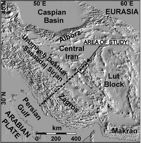
Figure 1.
Digital elevation model of the Arabia-Eurasia convergence zone. Rectangle shows the position of the study area (Fig. 2); black dashed line shows the location of the lithospheric-scale cross section (Fig. 4) from the Arabian plate through the Central Iranian plateau.