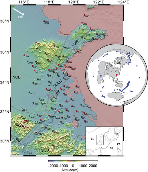
Figure 1.
Topography of eastern China and the distribution of seismic stations (red points). Gray lines represent the boundaries between tectonic units or major faults; the large white arrow indicates the absolute plate motion (APM) of the Eurasian plate (Gripp and Gordon, 2002). Blue dots in inset show the spatial distribution of earthquakes used in this study. EU—Eurasian plate; JXF—Jiashan-Xianshui fault; NA—North American plate; NCB—North China block; PA—Pacific plate; PS—Philippine Sea plate; QLDB—Qinling-Dabie orogenic belts; SCB—South China block; SULU—Sulu orogenic belt; TLF—Tan-Lu fault; XGF—Xiangfan-Guangji fault; XSF—Xinyang-Shucheng fault; YQWF—Yintai-Qingdao-Wulian fault. All other abbreviations are station names.