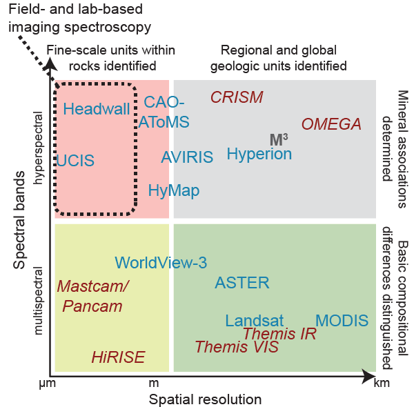
Figure 1.
Conceptual plot of the relative spectral sampling versus the spatial scales of observations by various imaging systems and the gap that ground-based imaging spectroscopy fills (dashed box). Blue text indicates imaging systems on Earth, red italicized text is for Mars, and gray bolded text is for the Moon. The number of spectral bands and the spatial resolutions used in this plot are generally those in the visible-shortwave infrared regions. The Headwall and Ultra Compact Imaging Spectrometer (UCIS) imagers were used to acquire data presented in this paper. ASTER—Advanced Spaceborne Thermal Emission and Reflection Radiometer; AVIRIS—Airborne Visible/Infrared Imaging Spectrometer; CAO-AToMS—Carnegie Airborne Observatory–Airborne Taxonomic Mapping System; CRISM—Compact Reconnaissance Imaging Spectrometer for Mars; M3—Moon Mineralogy Mapper; OMEGA—Observatoire pour la Minéralogie, l’Eau, les Glaces et l’Activité; HiRISE—High Resolution Imaging Spectrometer Experiment; MODIS—Moderate Resolution Imaging Spectrometer; THEMIS VIS/IR—Thermal Emission Imaging System (visible/infrared).