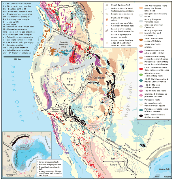
Figure 1.
Geological sketch map of west-central North America showing the two transverse structural zones and geologically relevant units. Geology from Reed et al. (2004) with local detail from sources cited in the text; 80 Ma contours of Cretaceous rocks from Roberts and Kirschbaum (1995); Great Basin calderas from Henry and John (2013); Late Cretaceous-Paleocene Sri isopleths from Armstrong et al. (1977). Inset: The Gulf of Mexico region simplified from Reed et al. (2004) showing the sinistral separation of Gulf salt (reflected in salt domes) and the southward truncation of the high-amplitude magnetic high that is interpreted to represent basalts of a volcanic rifted margin (Mickus et al., 2009). The Mexican ridges province is characterized by detachments in shale, whereas elsewhere in the Gulf, detachments are in salt (Rowan et al., 2004).