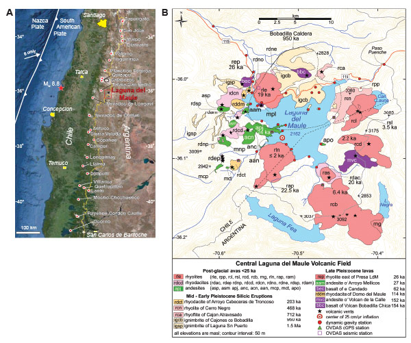
Figure 1.
(A) Location of Laguna del Maule volcanic field. Andean Southern Volcanic Zone frontal arc volcanoes are red circles. Red star denotes epicenter of MW 8.8 earthquake of 27 Feb. 2010 (base from Google Earth). (B) Simplified map of Laguna del Maule volcanic field adapted from Hildreth et al. (2010). Ages of lava flows determined by 40Ar/39Ar dating given in k.y.; many of these dates have been determined or revised recently (Andersen et al., 2013). The dam (la presa) at the northern outlet of the lake serves as a useful geographic reference.