 |
 |
 |
|
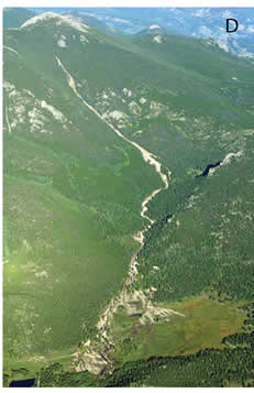 |
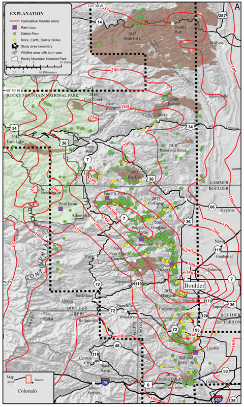
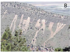
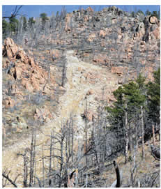
Figure 1.
Diagram showing debris flows triggered by September 2013 rainfall. (A) Map of debris-flow locations (as well as rock, earth, and debris slides) overlain by contours of cumulative rainfall from 10 September at 6 p.m. to 13 September at 6 p.m. Number of mapped debris flows was 1138. Number of mapped rock, earth, and debris slides was 212. (B) Debris flows at the contact between the Morrison Formation and Dakota Group on the southwest side of a hogback near Ralston Reservoir; visible relief is ~90 m. (C) Debris flow in the Overland wildfire burn area on Porphyry Mountain; visible relief is ~150 m. (D) Debris flow on the east side of Twin Sisters Peaks near Allenspark; visible relief is ~1000 m.