GSA Today
Volume 19, Number 9 (September 2009)
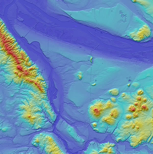
About the cover:
LiDAR image of Portland area, ~35 km 35 km, including confluence of NW-flowing Willamette River and W-flowing Columbia River. The Portland Basin’s SW margin is bounded by the Portland Hills escarpment, a folded-faulted ridge of Miocene Columbia River Basalt. Small Quaternary volcanoes pepper the basin; basin fill (center) was sculpted as late Pleistocene Missoula floods. Source topographic data courtesy Oregon LiDAR consortium and Clark County, Washington. See “The Portland Basin: A (big) river runs through it” by R.C. Evarts et al., p. 4–10.