
Inferring Wildfire Intensity from Quartz Luminescence
In this article
Inferring Wildfire Intensity from Quartz Luminescence
Pittsburgh, Pa., USA: On 8 June 2020, the Mangum Fire ignited 16 miles north of the North Rim of Grand Canyon National Park. By the time it was mostly contained, about a month later, the fire had burned over 70,000 acres of land.
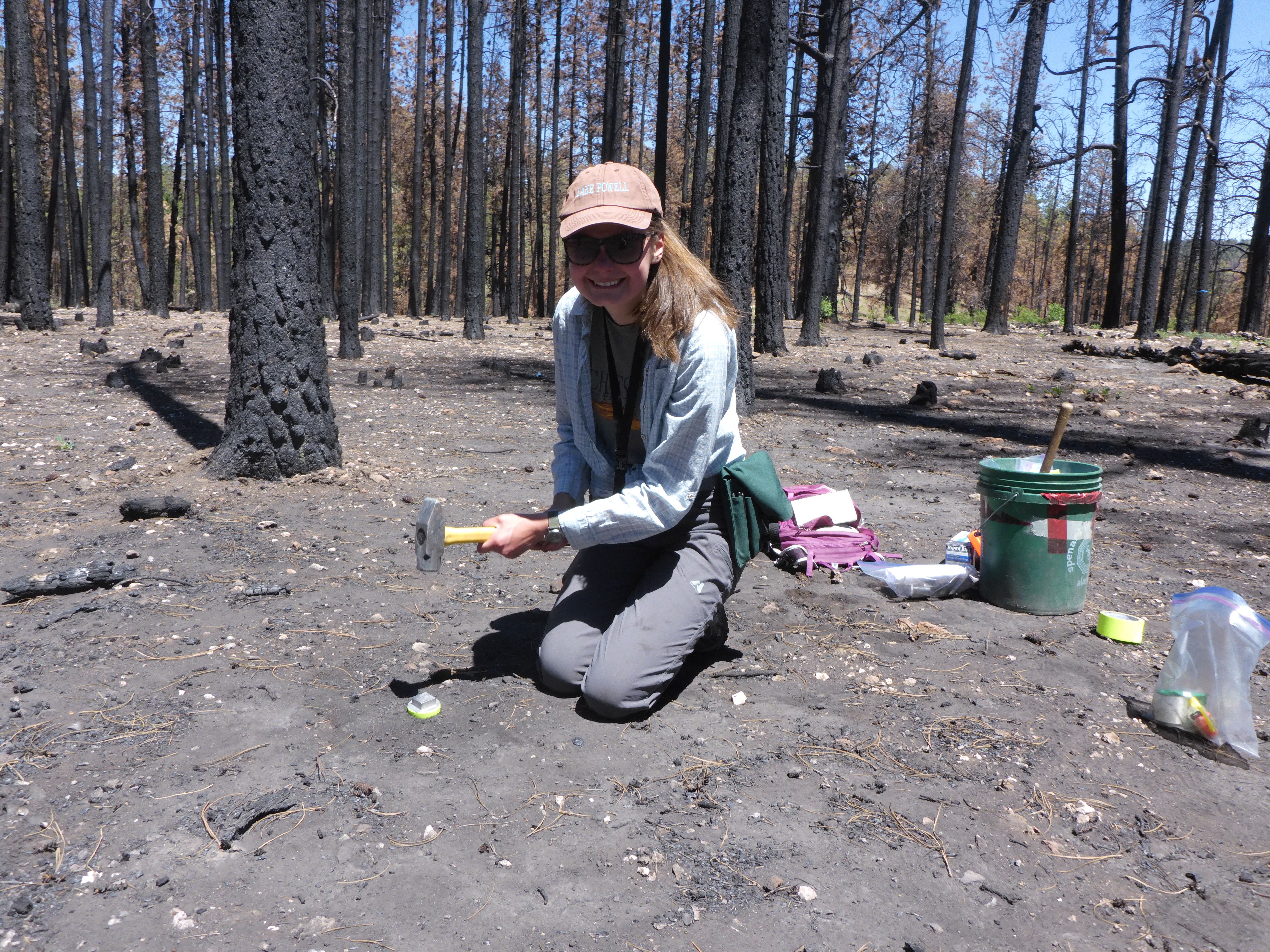
April Phinney, a M.Sc. candidate at Utah State University, immediately started drafting a burn intensity map based on remote sensing data. Six months later, she set boots on the burned ground and started collecting soil samples, hoping they would contain quartz grains. This research would become the basis of a presentation being given by Phinney’s advisor, Tammy Rittenour, on Sunday, 15 October at the Geological Society of America’s GSA Connects 2023 meeting.
Quartz may be the most common mineral on Earth, but it’s anything but boring. The focus of Phinney’s research was quartz’s ability to luminesce (i.e., emit light). When a mineral is exposed to ionizing radiation, some of its atoms will eject an electron. Most of the time these electrons fall quickly back to their parent atom. But in quartz, there are often structural defects in the crystal (e.g., a titanium or sodium atom replacing a silicon atom, or a missing oxygen), which create “positive traps.” The ejected electrons may thus be pulled to one of these defects, which will hold it (“trap it”) for millions of years—or until the crystal is exposed to light or heat. When this happens, the electron is set free from the structural defect and can drop to a lower energy state (such as an atom missing an electron), releasing a photon in the process and resetting the luminescence clock. Dating applications use this luminescence signal to determine the last time the mineral was exposed to light or heat. In this study the age of the fire was already known, and the researchers instead used a measurement of the luminescence sensitivity (light produced per dose of radiation) to identify quartz grains that been exposed to elevated heat, which enhances the luminescence properties.
Wildfires, of course, provide an enormous amount of heat to the soil they raze; it was therefore conceptually understood that the intensity of quartz luminescence should be higher in sediments that had been exposed to wildfires. However, this had never been field-tested before, and Phinney set out to do so for the first time. Using luminescence measurements from fire-affected soil, she would test the relationship between burn severity and luminescence intensity.
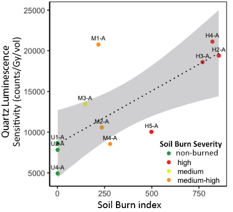
In the field, Phinney collected soil samples inside the fire perimeter in different burn intensity zones. To establish quartz’s baseline luminescence level, she also collected a few samples outside the fire perimeter, in areas that had not burned for at least 70 years, according to U.S. Forest Service records.
Her results show that soil samples collected in wildfire-affected areas luminesce more than soil samples collected outside the fire perimeter. The difference between burn severity areas is also clear, with high burn intensity samples luminescing up to twice as much as medium burn intensity samples. Phinney’s field testing demonstrates that wildfire burn intensity is recorded in the magnitude of quartz luminescence.
If quartz luminescence intensity is a fingerprint of fire exposure in surface soils, then it can be used to assess past fire intensity. Burn intensity maps only exist for very recent fires, but quartz luminescence intensity can help us look back in time up to two million years. These data can be used as a proxy for fire regimes, a measurement of how frequent and intense naturally occurring wildfires are in a particular ecosystem over a long period of time. Understanding these patterns is key to understanding and predicting current and future fire regimes, with important implications for hazard mapping and mitigation strategies throughout the southwestern United States.
Quartz as a Recorder of Fire Intensity: A New Proxy Record from Quartz Luminscence Intensity
Contact: April Phinney, april.ivy.phinney@gmail.com
14: T100. Advancements in the Science and Management of Wildfire Impacts on the Critical Zone
Monday, 16 October 2023, 11:20–11:35 a.m.
The Geological Society of America (https://www.geosociety.org) unites a diverse community of geoscientists in a common purpose to study the mysteries of our planet (and beyond) and share scientific findings. Members and friends around the world, from academia, government, and industry, participate in GSA meetings, publications, and programs at all career levels, to foster professional excellence. GSA values and supports inclusion through cooperative research, public dialogue on earth issues, science education, and the application of geoscience in the service of humankind.
# # #
Contact Information
Contributed by Arianna Soldati GSA Science Communication Fellow
Contact:
communications@geosociety.org
